
MOLINE, Ill. — The Quad Cities are recovering after the rollout of severe thunderstorms and tornadoes across the entire area Friday afternoon.
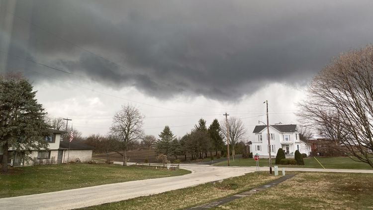
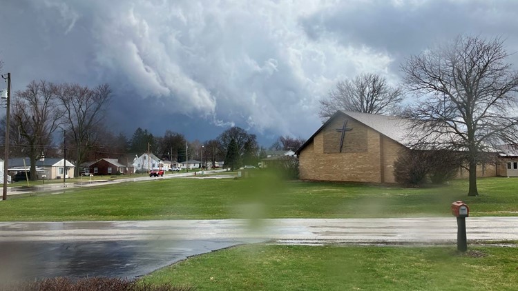
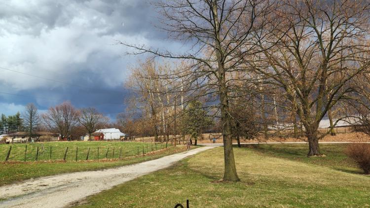
Heavy rain, fast winds and even blankets of hail were seen across the area, along with the dark funnels clouds of several tornadoes.
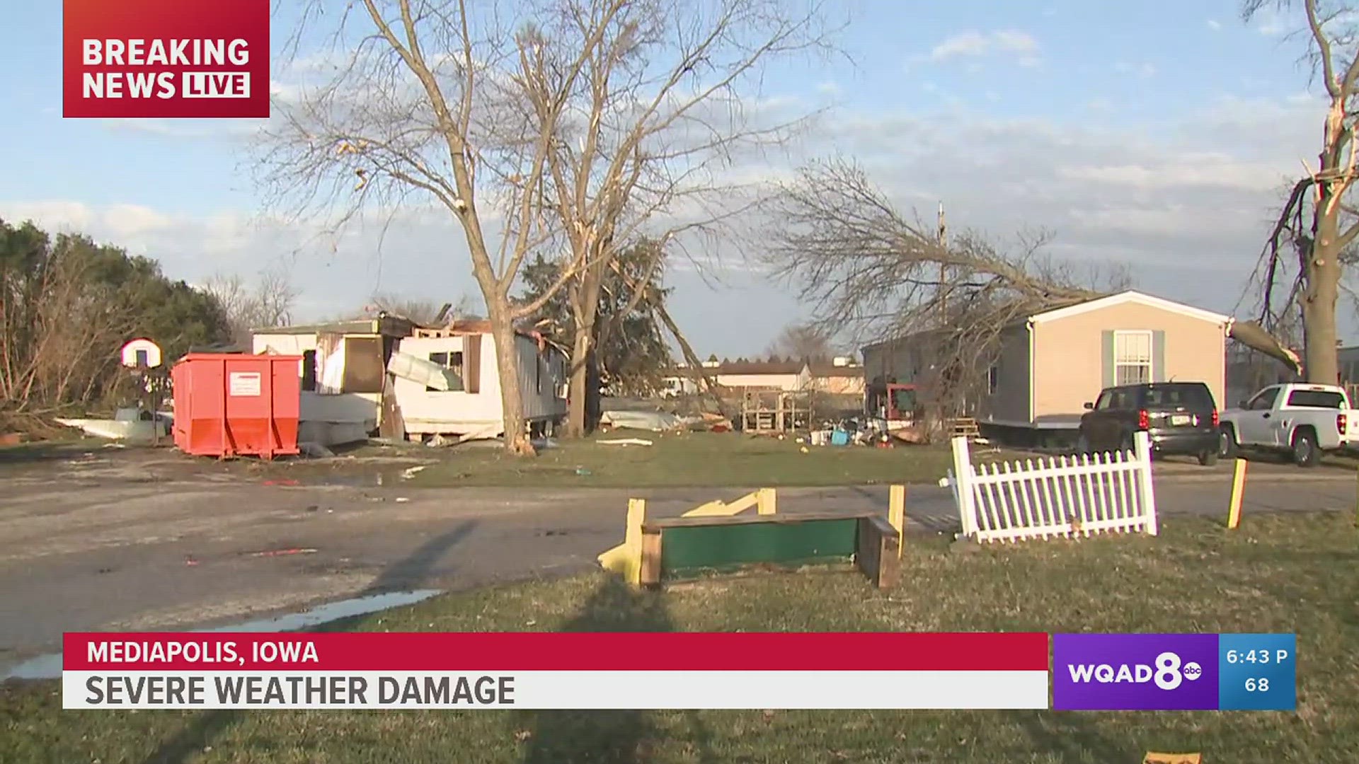
Several communities were left with significant damage, including Mediapolis, Geneseo, Kewanee and Grand Mound.
StormTrack8 is monitoring the aftermath and the damage done to several communities on both sides of the river. Check below for the latest updates.
Stay weather aware:
Severe weather on March 31


Mediapolis, Iowa has seen a significant amount of damage after the storms rolled through. News 8's Joe McCoy was on the scene surveying the wreckage and getting stories from residents.
Live Updates
9:08 p.m. | Power outages in the Quad Cities
There are still reports of outages across the Quad Cities area. Click the links below to see.
7:51 p.m. | The Geneseo Police Department published a news release reporting damage to several buildings on the west side of the town. Residents are asked to avoid the area around Center and Main Streets, as debris had been scattered that far east.
No injuries have been reported.
7:37 p.m . | The Des Moines County Sheriff's Office is asking onlookers to stay away from Mediapolis as public safety personnel, residents and first responders perform safety checks and cleanup. Traffic in the area will be restricted.
7:28 p.m. | The Clinton County Sheriff's Office is asking residents to stay home tonight while first responders deal with downed power lines and trees across the roads. Travelers are specifically asked to avoid Charlotte and Andover.
7:26 p.m. | After a confirmed tornado touchdown in Geneso, police are asking residents to steer claw of the area near Dilenbeck and Handford. No injuries have been reported at this time.
7:07 p.m. | A Tornado Warning is in effect in Stephenson and Carrol counties until 7:45 p.m.
6:52 p.m. | A Severe Thunderstorm Warning is in effect in Stephenson, Carroll, Jo Daviess and Whiteside counties until 7:30 p.m.
6:48 p.m. | A Severe Thunderstorm Warning is in effect in Henry, WHiteside and Carrol counties until 7:15 p.m.
6:42 p.m. | The Severe Thunderstorm Warning for the area around Kewanee, Geneseo and Morrison has been extended to 7:15 p.m.
6:31 p.m. | A Severe Thunderstorm Warning has been issued for Whiteside, Bureau, Henry, and Putnam counties until 7:30 p.m.
6:38 p.m. | The Severe Thunderstorm Warning for the area near Sterling, Kewanee and Rock Falls until 7:30 p.m.
6:37 p.m. | A Tornado Warning has been issued for Whiteside, Carrol and Stephenson counties until 7 p.m.
6:33 p.m. | A Tornado Warning has been issued for the area near Kewanee, Galva and Walnut, Illinois until 7 p.m.
6:30 p.m. | A Tornado Warning has been issued for Henry, Whiteside and Bureau counties until 7 p.m.
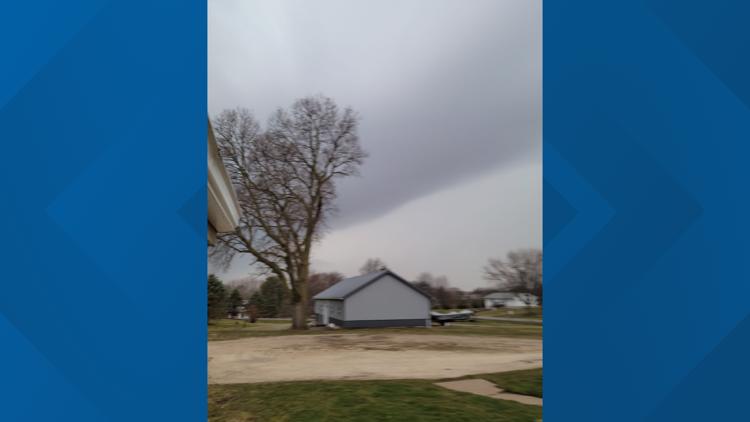
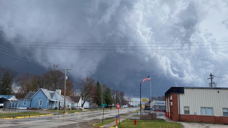
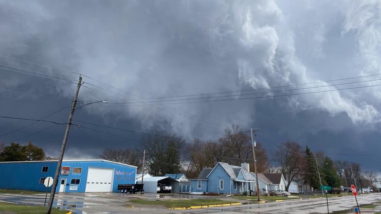
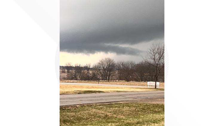
6:23 p.m. | News 8's Josh Lamberty and Morgan Strackbein shared these photos of a shelf cloud near Preemption around 6 p.m.
6:18 p.m. | A Tornado Warning has been issued for Carrol, Jackson, Clinton and Jo Daviess counties until 7 p.m.
6:17 p.m. | A Tornado Warning has been issued for Jo Daviess, Jackson, and Dubuque counties until 6:45 p.m.
6:13 p.m. | The Tornado Warnings in effect in the area near Savanna, Preston and Hanover have been extended to 7 p.m.
6:10 p.m. | The Severe Thunderstorm Warning in Knox County has been extended to 7 p.m.
6:08 p.m. | Severe Thunderstorm Warnings have been extended to 6:45 p.m. in Rock Island, Scott, Henry, Clinton, Whiteside, Mercer, Warren, Muscatine and Henderson counties
6:04 p.m. | A Severe Thunderstorm Warning has been issued for McDonough, Warren, Henderson and Hancock counties until 6:30 p.m.
6:02 p.m. | The Severe Thunderstorm Warning for Knox County has been extended to 7 p.m.
6:01 p.m. | A Tornado Warning has been issued for Clinton and Jackson counties until 6:45 p.m.
6:00 p.m. | A Severe Thunderstorm Warning is in effect in Linn, Jones, Dubuque, Delaware, Cedar, Clinton, Buchanan and Jackson counties until 6:45 p.m.
5:58 p.m. | A Tornado Warning has been issued for Mercer, Rock Island, Warren, Henderson, Des Moines and Louisa counties until 6:45 p.m.
5:57 p.m. | A Severe Thunderstorm Warning has been issued for parts of Warren and McDonough counties.
5:55 p.m. | A Tornado Warning has been issued for the area south of the immediate Quad Cities in areas like Coal Valley, Aledo and Viola.
5:48 p.m. | A Severe Thunderstorm Warning has been issued for Dubuque, Jo Daviess, Jackson, Carroll and Clinton counties until 6:45 p.m.
5:46 p.m. | A Tornado Warning has been issued for Scott, Muscatine, Clinton, Mercer and Rock Island counties until 6:30 p.m.
5:42 p.m. | The Tornado Warning for Jackson, Jones, Clinton and Cedar counties has been extended to 6:30 p.m.
5:42 p.m. | This huge twister was spotted on the ground in Hedrick, Iowa around 4:30!
5:40 p.m. | The Tornado Warning issued for Clinton, Cedar and Scott counties has been extended to 6:15 p.m.
5:37 p.m. | A Tornado Warning has been issued in the area of Lowden, Wheatland and Delmar, Iowa
5:29 p.m. | A Severe Thunderstorm Warning has been issued for Des Moines, Lee, Hancock, Henderson, McDonough, Clark, Henry and Warren counties until 6:15 p.m.
5:25 p.m. | Tracking Tornado Warnings for Cedar, Jones and Clinton counties until 5:45 p.m.
5:23 p.m. | A Severe Thunderstorm Warning lasting through 6 p.m. is now blanketing almost the entire QCA.
5:23 p.m. | A Tornado Warning has been issued for Muscatine, Cedar and Scott Counties until 6 p.m.
5:21 p.m. | Tracking Tornado Warnings for Johnson, Jones, Dubuque, Delaware, Linn, Cedar, Clinton and Jackson counties until 6 p.m.
5:18 p.m. | A Tornado Warning has been issued in the area of Wilton, Durant and Bennett until 6 p.m.
5:17 p.m. | The Quad Cities' four major power companies have reported a total of over 4,500 power outages around 5 p.m. after the first wave of storms.
5:00 p.m. | A Tornado Warning has been issued for Muscatine, Cedar and Johnson counties until 5:30 p.m. Residents should take shelter immediately.
4:39 p.m. | Tracking a Tornado Warning for Washington, Johnson and Louisa counties until 5 p.m.
4:26 p.m. | Tornado Warning issued for Bureau and Henry counties until 5:15 p.m. Residents should take shelter immediately.
4:18 p.m. Tracking a Severe Thunderstorm Warning for Whiteside and Carroll counties until 4:45 p.m.
3:57 p.m. | Tornado Warning issued for Brooklyn, Montezuma and Malcom, Iowa until 4:30 p.m.
3:53 p.m. | Tornado Warning issued for Tama, Toledia and Chelsea, Iowa until 4:45 p.m.
3:51 p.m. | Severe thunderstorm warning for Henry and Bureau counties until 4:30 p.m.
3:34 p.m. | A confirmed tornado touchdown has been spotted northeast of Ottumwa, Iowa.
3:39 p.m. | Severe Thunderstorm Warning for Knox County extended until 4 p.m.
3:35 p.m. | Tracking a Severe Thunderstorm Warning for Bureau and Putnam counties until 4:15 p.m.
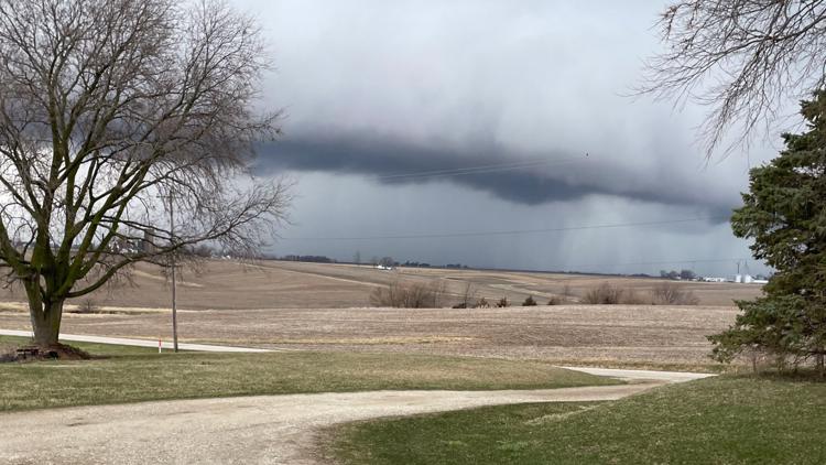
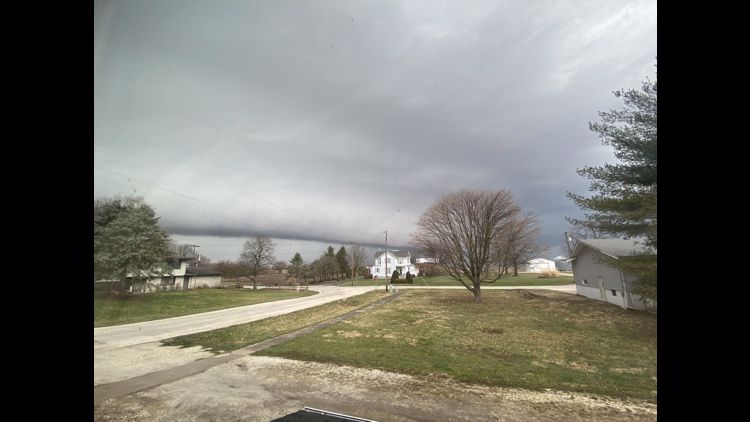
3:30 p.m. | Storm chaser Cory Marshall shared this photo of a large wall cloud developing southwest of Galesburg and heading toward Monmouth
3:27 p.m. | A Severe Thunderstorm Warning has been issued for the northeastern Quad City area until 4: 15 p.m., including Clinton, Silvis and Colona.
3:21 p.m. | The Severe Thunderstorm Warning for the area around Ottumwa, IA has been extended to 4 p.m.
Winds are expected to reach up to 60 miles an hour and baseball-sized hail is possible. Residents should seek shelter now.
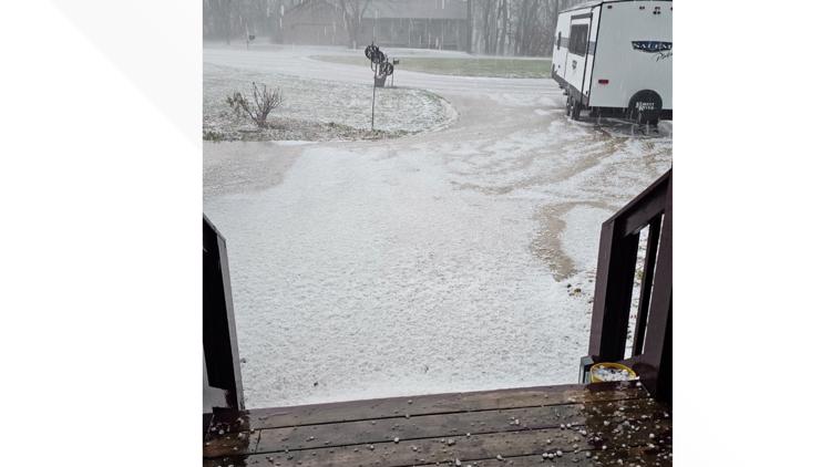
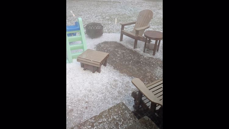
3:03 p.m. | A viewer showed us this photo from Ames, Iowa of a blanket of hail completely covering the ground!
3:04 p.m. | Tracking a Tornado Warning for Warren and Henderson counties until 3:45 p.m. Residents in those areas should take shelter now.
3:00 p.m. | Tornado Warning issued for the area around Monmouth, IL until 3:45 p.m.
2:57 p.m. | Severe Thunderstorm Warning for the immediate Quad City area extended to 3:45 p.m.
2:49 p.m. | Tornado warning around the area of Pekin and Peoria in Illinois until 3:15 p.m.
2:28 p.m. | Tornado Warning around the Canton, IL area until 3 p.m.
2:27 p.m. | Tracking a Severe Thunderstorm Warning for Knox, Fulton, Stark and Peoria counties until 3:15 p.m.
2:18 p.m. | The Severe Thunderstorm Warning for Rock Island, Scott, Henry and Louisa counties has been extended to 3 p.m.
2:16 p.m. | Severe Thunderstorm Warning for the southern end of the QCA extended to 3 p.m.
The warning includes winds of up to 60 miles an hour and the possibility of quarter-sized hail.
2:11 p.m. | Tracking a Severe Thunderstorm Warning for Muscatine, Louisa, Rock Island and Mercer counties until 2:45 p.m.
The QCA has also been upgraded to level 5 out of 5 for severe storms due to the increased chance of tornadoes.
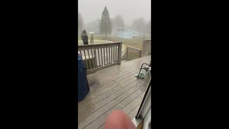
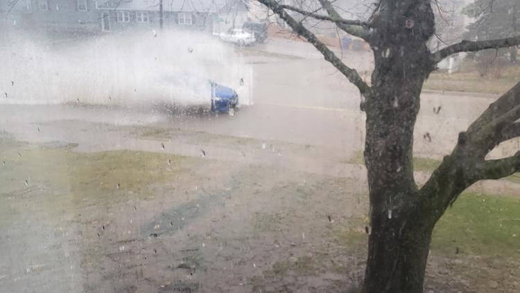
2:08 p.m. | News 8's Joe McCoy is stationed in Burlington and shared a video of the newly-started downpour
2:07 p.m. | Severe Thunderstorm Warning in the Muscatine area until 2:45 p.m.
12:35 p.m. | Storm Center calls Tornado Watch a "particularly dangerous situation"
Several tornadoes, scattered large hail and scattered damaging gusts are expected.
12:12 p.m. | United flight from Chicago canceled
The Quad Cities International Airport's arrivals page says one flight from Chicago has been canceled.
Check out the arrival and departure statuses below:
11:59 a.m. | Here are the probabilities associated with the Tornado Watch
The probability of two or more tornadoes is very high, 95%. Have a plan and make sure you are taking shelter once a warning is issued.
11:47 a.m. | Tornado Watch issued for the Quad Cities, surrounding areas
Tornadoes, hail and wind are expected Friday. The watch will last through 8 p.m.
11:42 a.m. | What are the risks for today?
The threat of tornadoes continues to increase in our area. This is especially true for those along and south of Interstate 80.
11:35 a.m. | 5/5 Threat Level issued for the Quad Cities
That means the QC is likely to experience damaging storms Friday. Have a plan and be ready for storms to arrive after 2 p.m. The last time a threat like this was issued was June 12, 2013.
11:29 a.m. | Tornado Watch will be announced soon
StormTrack8's Andrew Stutzke says a PDS, or Particularly Dangerous Situation, Tornado Watch will be issued for parts of the region shortly.
10:47 a.m. | Storm Prediction Center to upgrade threat level to 5/5
StormTrack8's Andrew Stutzke says parts of the Quad Cities will be under a 5/5 threat level within the next hour. Plan and prepare now for this storm. This is the highest risk possible.
10:12 a.m. | Several Bettendorf facilities, several QC schools closing early
Family Museum, Bettendorf Public Library, Bettendorf Community Center and Palmer Hills Golf Course will be closing early Friday.
7:51 a.m. | Strong winds expected Friday afternoon through Saturday afternoon
The National Weather Service of the Quad Cities anticipates driving difficulties during this time, especially for high-profile vehicles driving on east-to-west roads. Make sure your loose items are tied down!
7:46 a.m. | Level 4 risk just got a lot more company
A significant severe weather outbreak is very likely today. Make sure you have a plan ready!
5:26 a.m. | What's the timing of Friday's storm?
StormTrack8 Meteorologist Andrew Stutzke says the timing will be between 3-8 p.m. overall for storms Friday evening. Tornadoes, some strong, wind gusts exceeding 70 mph and up to tennis ball-sized hail are possible.
Make sure you have a way to receive warnings, one way can be downloading the News 8 news app or weather app. Click/tap here for more information.