
MOLINE, Ill. — Wind, wind and more wind. It's the season of wind that never seems to end here in the Quad Cities, no matter what temperatures our thermometers seem to be registering. So what gives? Why are we constantly seeing strong breezes this spring season? Let's dig in!
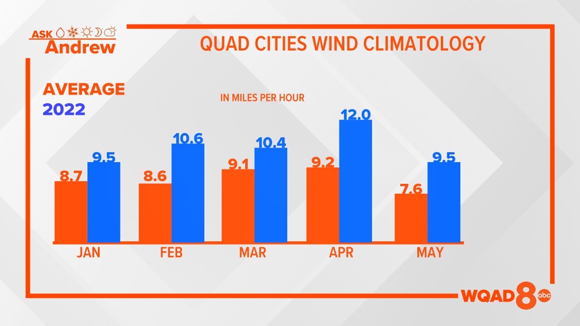
Using historical wind data for the Quad Cities, we can plot and compare the average wind speed for each month to the actual observed average wind speed for this year. From January through May in the Quad Cities, we have surpassed each month's average wind speed, some months more than others. April was an especially windy month with an average wind speed of 12 mph, fairly impressive for that time of year!

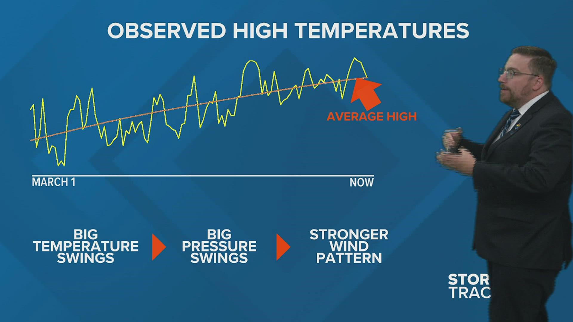
Going back to a previous session of StormTrack 8 University where we discussed air pressure, we know that changes in pressure are driven by changes in temperature. It's nature's way of trying to balance energy, more specifically, heat energy across the globe.
When you have a stable temperature pattern, one that doesn't have huge day-to-day swings, pressure changes are often quite smooth and gradual. However, if you have a temperature pattern as we've had for much of this year, that involves big swings from day to day, you develop a fairly volatile pressure pattern with constant ups and downs.

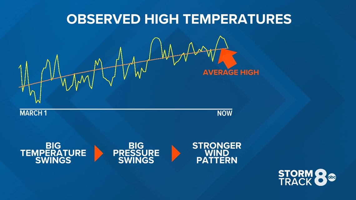
The graph above shows our observed high temperatures in yellow versus the normal high each day from March 1 through June 18. Notice there are several sharp, jagged edges to the yellow part of the graph. There are hardly any smooth areas. These are the big temperature swings responsible for all of the wind around here this spring. We haven't really had a stretch of days that featured temperatures with little to no change. Instead, we've had a number of extremes, including that early run of the 90s in May that also came with a lot of wind.
During the summer months, winds typically reach their lowest average wind speed here in the Quad Cities as the temperature pattern becomes more stable. Widespread warmth takes over much of the U.S. and active jet streams carrying more cooler air remain north of us.
In contrast, for the fall, winter and spring months, the temperature changes become even greater allowing not only stronger winds but also forming more powerful areas of high and low-pressure systems that feed into the energy from those temperature differences.
Have a question that you would like me to answer for an upcoming "Ask Andrew" segment? Submit it, here!