
MOLINE, Ill. — The waters of the eastern Pacific Ocean continue to warm as we approach the final weeks of meteorological summer here in the Quad Cities, meaning an El Niño pattern is gaining strength.
A new outlook released by the National Oceanic and Atmospheric Administration (NOAA), is calling for a 95% probability of seeing El Niño conditions continuing through the spring of 2024. There is now a 2 in 4 probability that the peak Oceanic Niño Index this winter matches or exceeds an informal threshold for a "strong" El Niño event. This is higher confidence compared to a month ago because the sea surface temperature is already 1°C warmer than average.


The previous strong El Niño occurred in 2015-2016. Notable events of interest here in the Quad Cities during that timeframe include tornadoes in November and December, along with a particularly active spring severe weather season in 2016. While there is high confidence that we will have El Niño through at least the upcoming season, the extent of the impact of that pattern remains in question.
Oceans are already warm
You've likely already heard about the recent unusually warm global average temperatures, breaking records most recently in July. Even the oceans are warm and there have been several prolonged episodes of heat. This El Niño, however, is just now getting started and can't be blamed specifically for all of these heat events that we've racked up already this year.
There is, however, a good chance that it will continue to push the global average temperature into at least a top-3 average for 2023. You can read more about how NOAA predicts the global average temperature, here.


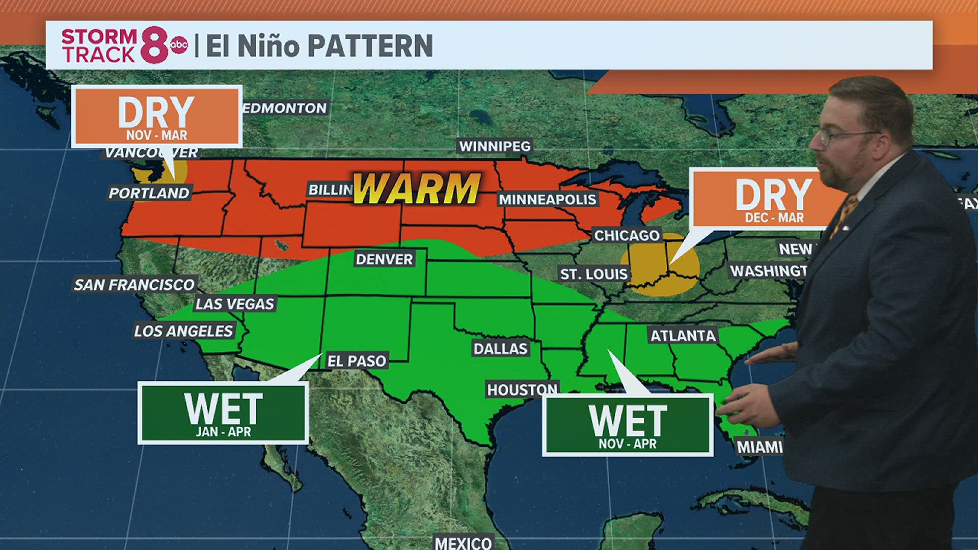
On average, the above image represents the typical El Niño impacts on the overall weather pattern in the U.S. The south half of the country is typically very active with rainfall remaining plentiful. Meanwhile, in the northern U.S., temperatures are typically warmer than normal, especially in the winter.
What models are predicting currently
The graphic below shows the global average temperature forecast from one model that is relative to the "pre-industrial" period or the increase in global average temperature since 1850. Each different colored line represents the most recent forecasts made from April through the end of August on the right-hand side. The gray lines are forecasts from previous years. The dark black line shows the observed global temperature.

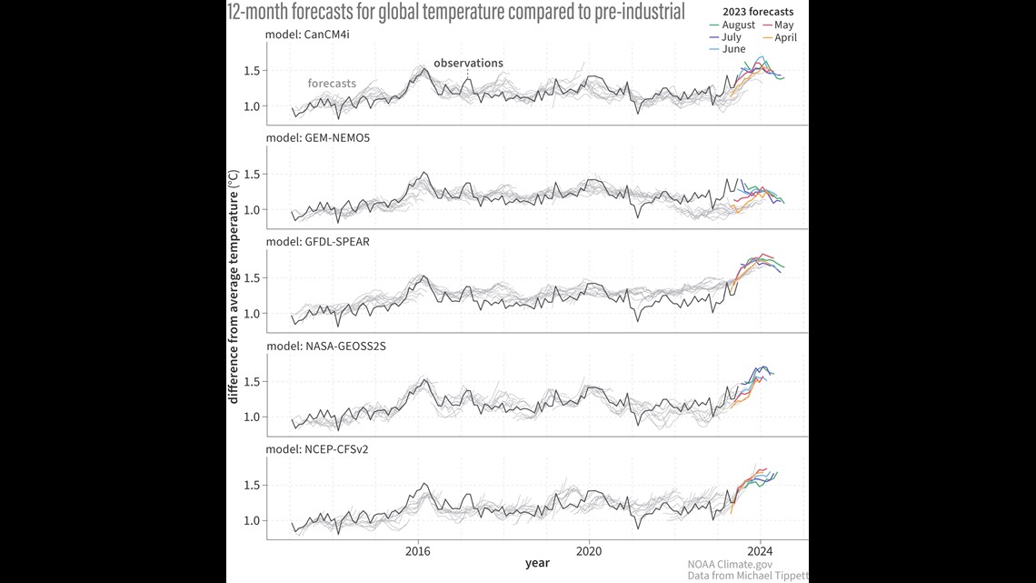
This image is useful because it shows the amount of variation when it comes to these long-range outlooks. While some models indicate that our global average temperature will significantly exceed what we measured in 2016 during the last strong El Niño event, there are some that show we won't. Notice though that nearly all of them agree there will be an upward trend heading into the beginning of 2024!
Have a question you would like me to answer for an upcoming Ask Andrew segment? Submit it, here!
Watch more news, weather and sports on News 8's YouTube channel