
MOLINE, Ill. — Some severe weather is anticipated for parts of the Quad Cities viewing area late Thursday morning into the early afternoon. Our risk increased overnight with areas along and south of Interstate 80 now in a Threat Track level 3 out of 5 risk for severe storms.
StormTrack8 is monitoring the storm as it passes through the Quad Cities area. Check below for the latest updates.
Live Updates:
Stay weather aware:
6:00 p.m. | The 381 Illinois Service Amtrak was stopped in Bushnell, Illinois. It is now moving but running around six and a half hours late.


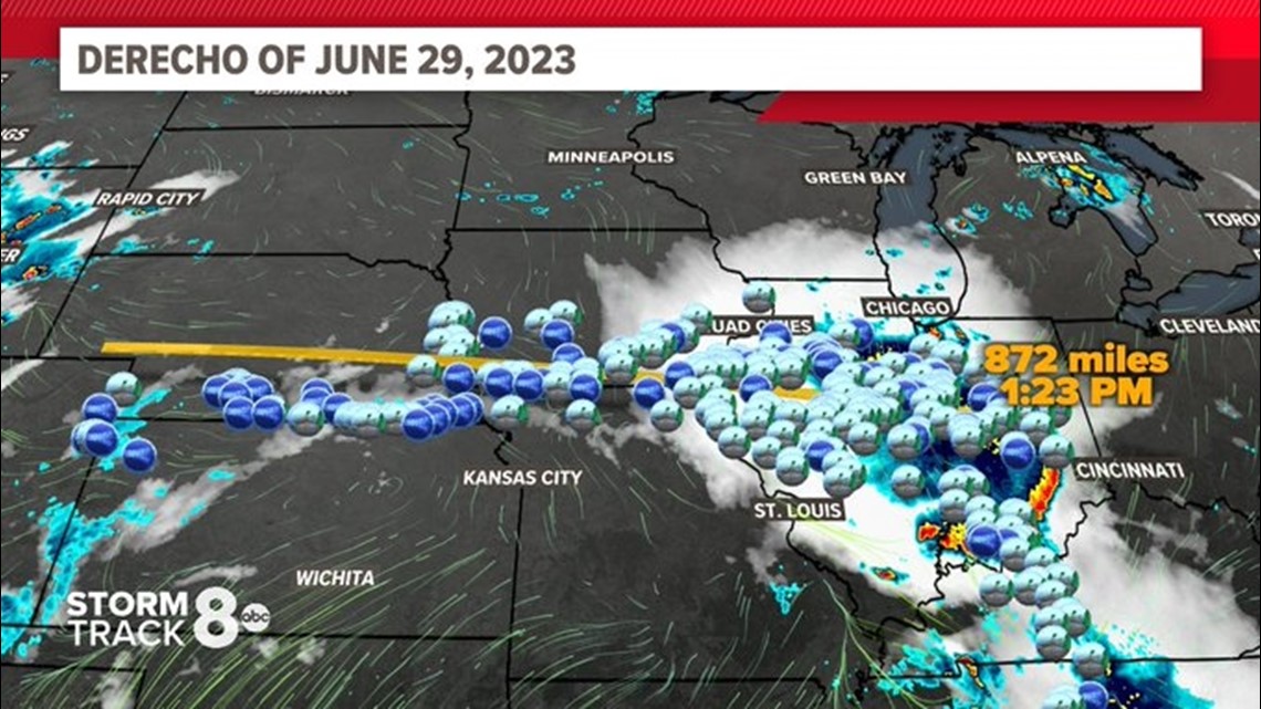
3:40 p.m. | This severe weather system can be classified as a derecho, according to our meteorologist Andrew Stutzke
A storm is classified as a derecho if wind damage swath extends more than 240 miles and has wind gusts of at least 58 mph or greater along most of the length of the storm's path. The top wind gust in our area was 90 MPH in Adrian, IL, close to Fort Madison, IA.

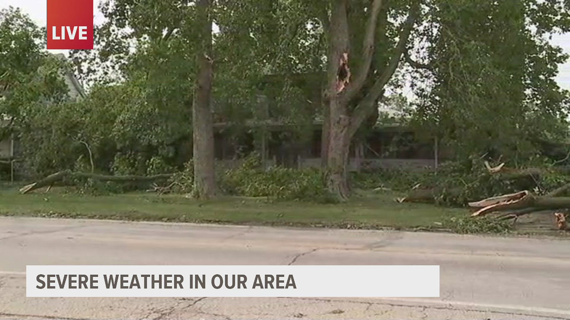
1:00 p.m. | Tree and road damage in Fort Madison, IA


12:27 p.m. | Track power outages in the Quad Cities
12:30 p.m. | Damage to the steeple of St. Mary and Joseph church in Fort Madison, IA


12:20 p.m. | Minor tree damage and isolated flooding in Galesburg
11:36 a.m. | City of Fort Madison asks citizens to refrain from driving around town
12:05 p.m. | Current view of the I-74 bridge


12:01 p.m. | Severe weather moving into the Quad Cities
11:51 a.m. | Severe Thunderstorm WARNING continues for Andalusia IL, Viola IL and Alexis IL until 12:00 p.m. CDT
11:48 a.m. | Severe Thunderstorm WARNING including Davenport IA, Moline IL and Rock Island IL until 12:30 p.m. CDT
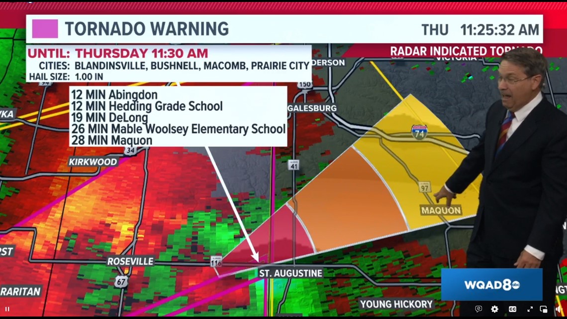
11:41 a.m. | Rotation detected east of Abingdon, over Maquon
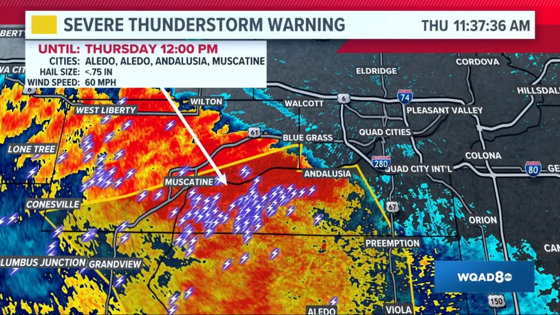
11:37 a.m. | Severe Thunderstorms moving towards the Quad Cities, expected to hit in less than 20 minutes

11:31 a.m. | Severe Thunderstorm WARNING continues for Macomb IL, Monmouth IL and Bushnell IL until 11:45 a.m. CDT
11:29 a.m. | High probability of dime-sized hail southeast of Muscatine, heading towards the Quad Cities
11:25 a.m. | Tornado path and projected impact times in Abingdon, Hedding Grade School, DeLong, Mable Woolsey Elementary School and Maquon

11:21 a.m. | Severe Thunderstorm WARNING including Mount Sterling IL, Camp Point IL and Payson IL until 12:00 p.m. CDT
11:19 a.m. | Severe Thunderstorm WARNING continues for Columbus Junction IA, Morning Sun IA and Columbus City IA until 11:45 a.m. CDT
11:17 a.m. | Severe Thunderstorm WARNING and projected path

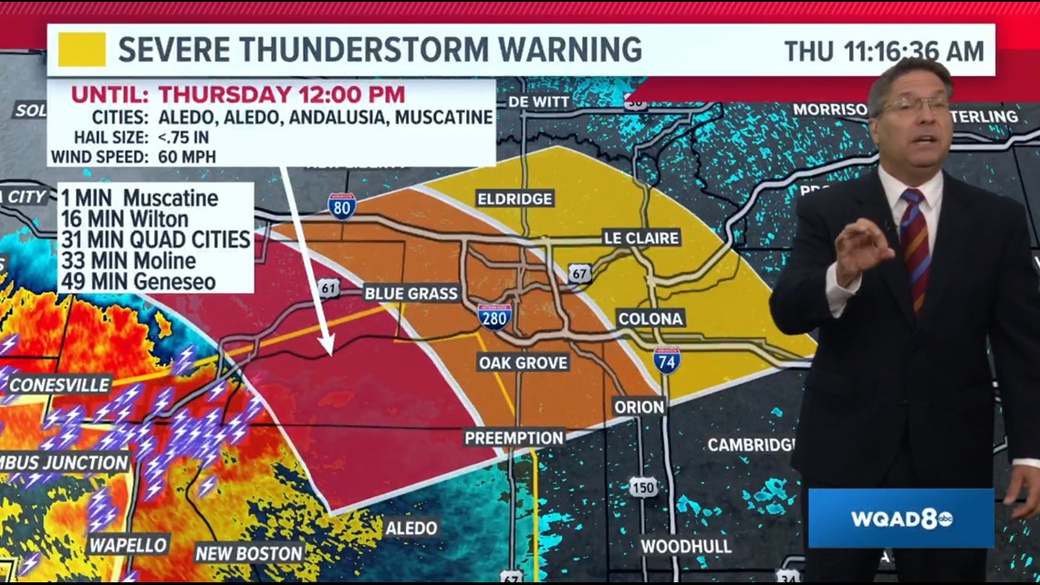
11:14 a.m. | Severe Thunderstorm WARNING including Muscatine IA, Aledo IL and Wapello IL until 12:00 p.m. CDT
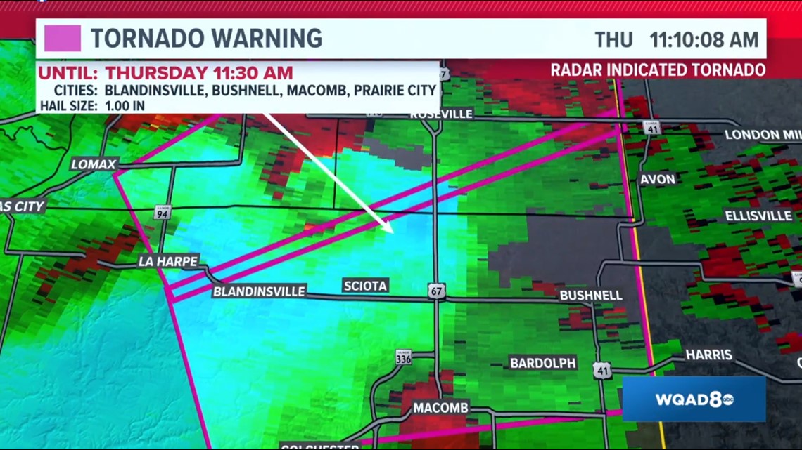
11:10 a.m. | CONFIRMED Tornado heading towards Roseville

11:05 a.m. | Severe Thunderstorm WARNING continues for Burlington IA, Macomb IL and Fort Madison IA until 11:45 a.m. CDT
11:02 a.m. | Tornado WARNING including La Harpe IL, Roseville IL and Stronghurst IL until 11:30 a.m. CDT
10:54 a.m. | Tornado WARNING including Macomb IL, Bushnell IL and Colchester IL
10:17 a.m. | Severe Thunderstorm WARNING for some Iowa counties
9:34 a.m. | Timing of severe storms
The National Weather Service says storms are expected to move eastward across the Quad Cities area on Thursday morning, with the timing of some of these storms speeding up. The threat should expire by 3 p.m.
Watch the latest forecast on News 8's YouTube channel