
MOLINE, Ill. — Update: This severe weather threat has ended.
Previous story:
Severe thunderstorms are forecasted to move into the News 8 viewing region Tuesday into early Wednesday.
Two waves of storms are predicted, according to Storm Track 8's Chief Meteorologist James Zahara. The first will develop near the early afternoon hours to our southwest in Missouri, and will quickly move northeast. The second wave will develop around southeast Iowa and move northeast as well around the 6 p.m. to 7 p.m. hours. The threat should end after 9 p.m.
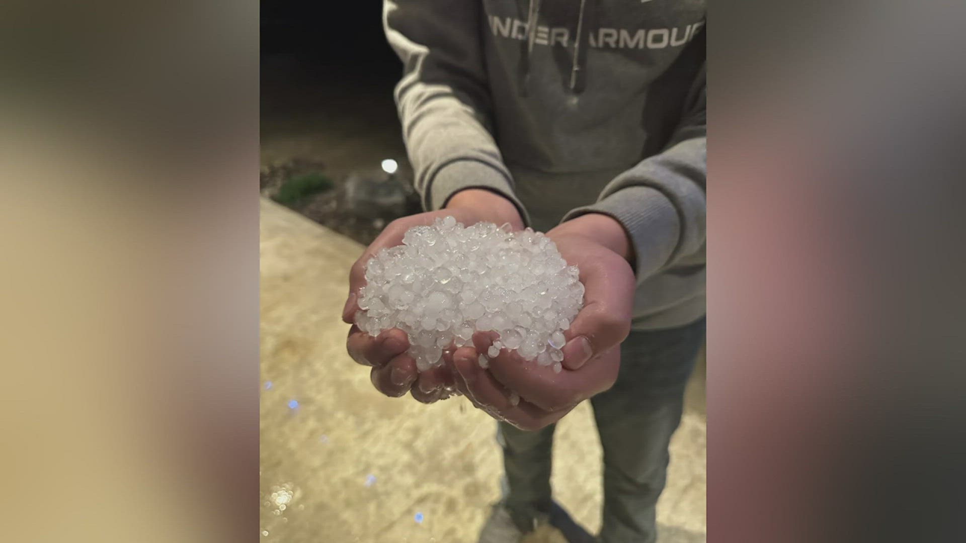
The main hazards include large hail, damaging wind and isolated tornadoes.
StormTrack8 is monitoring the storm as it passes through the Quad Cities area. Check below for the latest updates.
Need tips on how to stay safe during severe weather? Check out the National Weather Service's Severe Weather Safety Guidelines here.
Stay weather aware by downloading the Storm Track 8 mobile app to get live weather alerts sent straight to your phone.
Follow the StormTrack8 weather team on social media:
Live Updates
8:54 p.m. | Tornado watches around the Quad Cities Area are expiring, aside from Bureau and Putnam County, which expire at 10 p.m.
8:30 p.m. | A severe thunderstorm warning is in effect until 9:15 p.m. for Stephenson and Jo Daviess Counties.
8:04 p.m. | A severe thunderstorm warning is in effect for parts of Sterling, Rock Falls and Morrison until 8:45 p.m.
7:42 p.m. | A severe thunderstorm warning is in effect for Henry, Rock Island and Whiteside Counties until 8:30 p.m.
7:25 p.m. | Update from NWS Quad Cities as storm system continues to move through
7:21 p.m. | A severe thunderstorm warning is in effect for Stephenson, Carroll and Jo Daviess Counties until 8:15 p.m.
7:05 p.m. | A severe thunderstorm warning is in effect for the immediate Quad Cities area including Mercer, Clinton and Henry Counties until 7:45 p.m.
6:58 p.m. | A severe thunderstorm warning is in effect until 8 p.m. for Des Moines, Mercer, Warren, Henderson and Louisa Counties
6:43 p.m. | A severe thunderstorm warning is in effect until 7:30 p.m. for the northern parts of our viewing region
6:43 p.m. | A severe thunderstorm warning is in effect until 7:30 p.m. for many of our Illinois hometowns
6:27 p.m. | A live look at our radar
6:24 p.m. | A severe thunderstorm warning is in effect in the northern parts of our viewing region until 6:45 p.m.
6:22 p.m. | A severe thunderstorm warning is in effect for many of our Illinois towns now until 7:15 p.m.
6:01 p.m. | A tornado warning is in effect for many of our hometowns on the Iowa side until 6:45 p.m.
5:57 p.m. | A severe thunderstorm warning is in effect until 6:45 p.m. for the Quad Cities area and Muscatine County
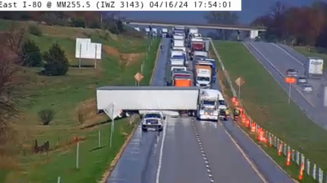
5:54 p.m. | Westbound I-80 near West Branch is blocked due to a crash, per the Iowa DOT

5:48 p.m. | A severe thunderstorm warning is in effect near Mount Pleasant, New London and West Point
5:42 p.m. | A severe thunderstorm warning is in effect for areas around Burlington, West Burlington and Mediapolis
5:39 p.m. | Storm Track 8 Meteorologist Evan Bunkers captures a tornado west of Mediapolis
5:23 p.m. | A tornado warning is in effect for Mercer, Rock Island and Louisa Counties until 6 p.m.
5:16 p.m. | A severe thunderstorm warning is in effect until 6 p.m. for much of our hometowns
5:13 p.m. | Tornado lifts silo across road near Salem, Iowa
5:07 p.m. | Update from NWS Quad Cities as line of severe storms continues to move across region
5:03 p.m. | A severe thunderstorm warning is in effect until 5:45 p.m near the Dubuque area
4:58 p.m. | A severe thunderstorm warning is in effect until 5:15 p.m. for the northwest part of the News 8 viewing region
4:56 p.m. | A tornado warning is in effect for parts of Des Moines, Lee, Hancock, Henderson and Clark Counties
4:50 p.m. | A severe thunderstorm warning is in effect for our hometowns to the north
4:39 p.m. | Tornado spotted near Mount Pleasant, Iowa
4:35 p.m. | NWS Quad Cities releases estimated times for when severe weather system could hit some of our hometowns
4:29 p.m. | Wall cloud spotted near Donnellson, Iowa
4:26 p.m. | A severe thunderstorm warning is in effect for many of our Iowa hometowns
4:20 p.m. | NWS Quad Cities advises those in the southern part of Henry County, Iowa, along with Lee and Van Buren Counties to take cover
4:19 p.m. | Rotation near Iowa City has strengthened, according to NWS Quad Citie
4:18 p.m. | A tornado warning is in effect near Iowa City, Mount Vernon and Lisbon until 4:45 p.m.
4:14 p.m. | A tornado warning is in effect for parts of Henry and Lee Counties in Iowa
4:11 p.m. | NWS Quad Cities says there is tornado potential in the southern parts of the News 8 viewing region
3:44 p.m. | A severe thunderstorm warning is in effect for parts of Henry County, Iowa until 4:30 p.m.
3:39 p.m. | A second wave of storms is set to hit the Quad Cities metro around 5:30 p.m.
3:24 p.m. | First wave moving through the News 8 viewing region isn't producing anything severe
3:00 p.m. | A severe thunderstorm warning is in effect until 3:45 p.m. for the western parts of the News 8 viewing region.
2:27 p.m. | Live Doppler radar update
2:23 p.m. | Severe weather hazard probabilities from Storm Track 8's Andrew Stutzke
1:44 p.m. | Afternoon update from NWS Quad Cities
12:04 p.m. | A tornado watch is in effect for most of our hometowns until 8 p.m.
11:55 a.m. | Midday update from NWS Quad Cities on when severe weather is expected in the region
Watch more news, weather and sports on News 8's YouTube channel