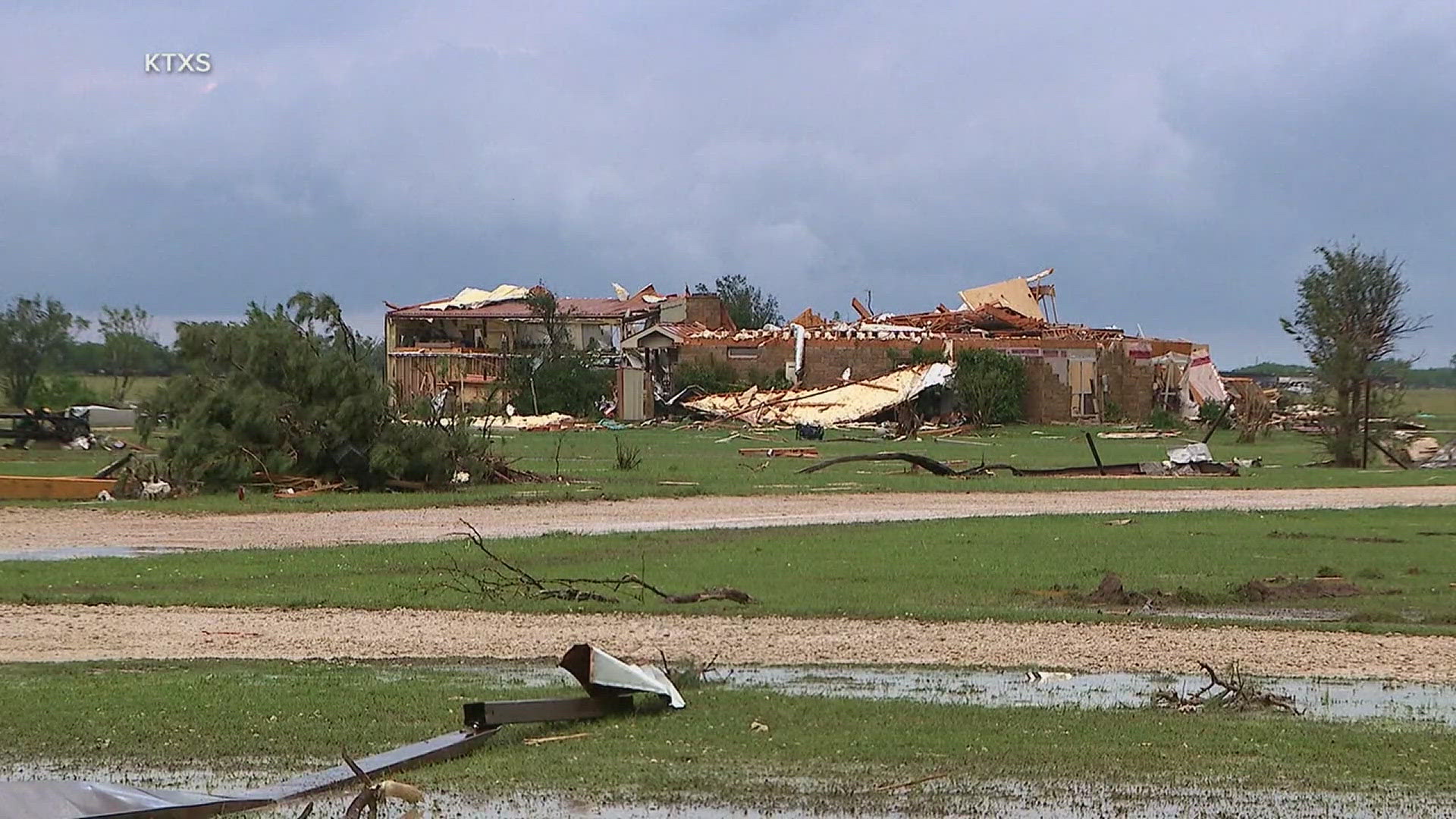
MOLINE, Ill. — Severe thunderstorms are forecasted to move into the News 8 viewing region Tuesday into early Wednesday.
A broken line of showers and thunderstorms will develop to our west and advance east by the mid-afternoon hours and into the early evening. Threats include large hail, damaging wind and isolated tornadoes, according to Storm Track 8's Chief Meteorologist James Zahara.
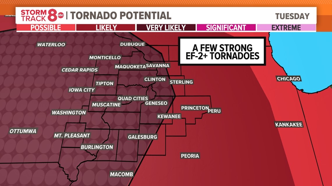
The National Weather Service Quad Cities says strong to severe storms are expected across eastern Iowa and northwest Illinois as a warm front travels north. There is a level 3 out of 5 threat for the immediate Quad Cities area, along with our hometowns to the south and west. There is a level 2 threat to the east and north.


When will the storms move through?
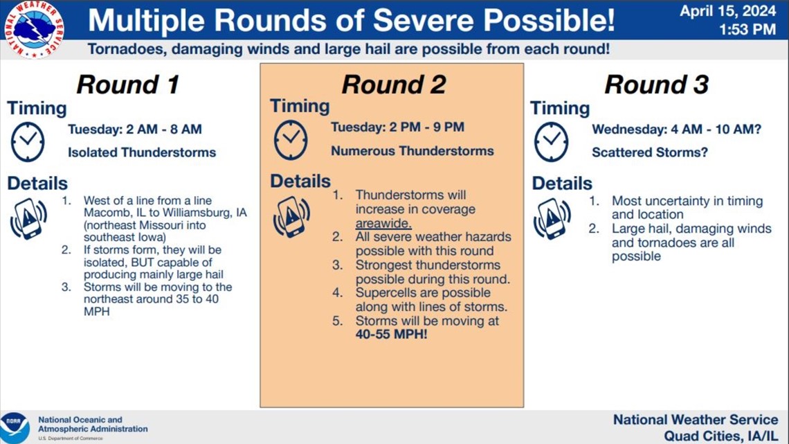
NWS Quad Cities predicts three rounds of storms to move through the region. The first round of Isolated thunderstorms will be early Tuesday morning from about 2 to 8 a.m., and then a round of scattered storms is forecasted for early Wednesday from 4 a.m. to around 10 a.m.
The main round of severe weather is expected between 2 p.m. and 9 p.m. Tuesday, where thunderstorms will increase in coverage across the area. NWS Quad Cities says all severe weather hazards are possible during this time.

What are the main severe weather threats?
Areas in the level 3 out of 5 threat have a higher potential for some tornadoes and large hail. Hail 2 inches or more in diameter could be possible, along with a few strong tornadoes.


The big key come tomorrow will be the duration of sunshine after our morning event leaves. If the clouds linger before the later day activity arrives, then some isolated strong storms will be expected. If we see several hours of sun, then greater instability and convective energy will be available to produce clusters of severe storms.
Once the system departs, then windy and cooler highs will follow for the rest of the work week with a later day shower possible both Wednesday and Thursday.


Need tips on how to stay safe during severe weather? Check out the National Weather Service's Severe Weather Safety Guidelines here.
Stay weather aware by downloading the Storm Track 8 mobile app to get live weather alerts sent straight to your phone.
Follow the StormTrack8 weather team on social media:
Watch more news, weather and sports on News 8's YouTube channel