
MOLINE, Ill. — As Midwesterners, we know that the weather can get a little crazy from time to time. But, what about so crazy that you go from record-breaking heat to record-breaking snowfall in just a matter of days? That's exactly what happened in the year 1942, September to be more exact, as the Quad Cities experienced one of the earliest snowfalls on record.
September is known as being a transition month in general. The length of daylight is decreasing and the sun's angle is also decreasing right along with it. Pockets of cold air are beginning to develop in parts of northern Canada and it's just a matter of time before that cold arrives in the Midwest.
This particular year, however, it arrived way ahead of schedule.
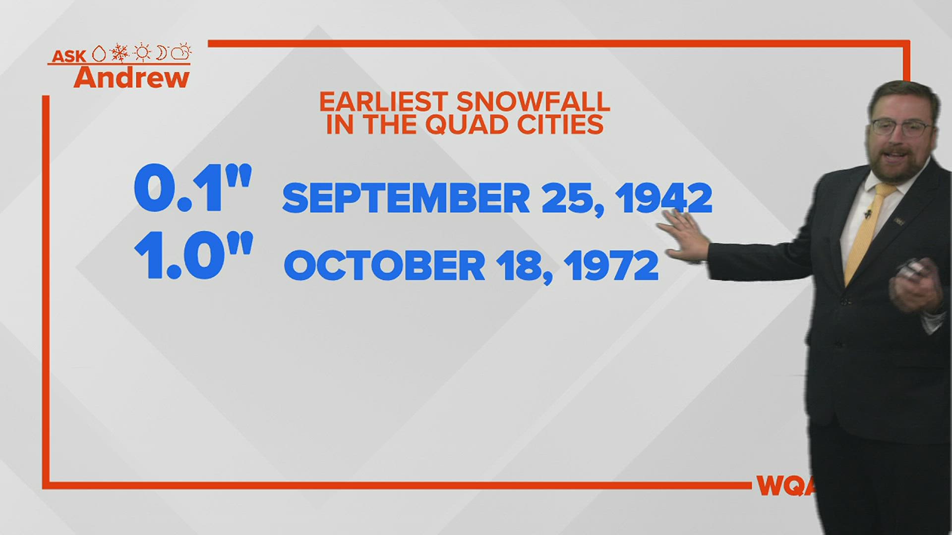
It was Sept. 25, 1942, when the Quad Cities measured a tenth of an inch of snowfall. How is this possible so early in the season? The meteorological setup is quite impressive.

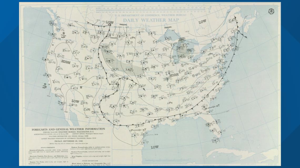
A surface low-pressure system moved through southern Alberta, Canada into parts of the Dakotas. Temperatures were some 20-to-30 degrees cooler than normal at this time, paving the way for snow to develop.
Daily high-temperature records for Moline, as shown above, point out exactly how significant the temperature drop was as this storm system moved through the region. Just days prior to the snow, Moline recorded two record high-temperature days with temperatures well into the upper 80s and near 90.
What followed was a big drop in daytime temperatures, as low as the middle 40s!


While we had light amounts here in terms of snowfall, our neighbors to the north in Minnesota and Wisconsin saw even more, with many locations receiving at least three inches of heavy, wet snow. Another hefty band of snow also set up south of the Quad Cities, towards central Illinois where many reports of more than two inches of snow were observed.
To give you a better idea of how unusual this storm system was, the Quad Cities typically logs the first inch of snow around Nov. 24 on average.
Have a question you would like me to answer for a future Ask Andrew segment? Submit it, here!
WATCH | WQAD Throwback: Groundhog Day blizzard of 2011 leads to neighborhood cooperation