
THOMSON, Ill. — Just north of the Quad Cities, a handful of islands have gone to the birds.
Since 1992, colonies of white pelicans began making the annual trip up to the Mississippi River's Lock and Dam 13. Then in 2007, the birds made history.
"It was the very first nesting that we've ever seen on the main river channel, the upper Mississippi River," said Ed Britton, the Savanna District Manager for the U.S. Fish & Wildlife Service's Upper Mississippi River National Wildlife and Fish Refuge.
In the years that have followed, it remains the only documented instance of the birds nesting right in the middle of the river's main upper channel. To do so, the pelicans gather on large, sandy islands. Surrounded by waves, the eggs are plopped right onto the beach.
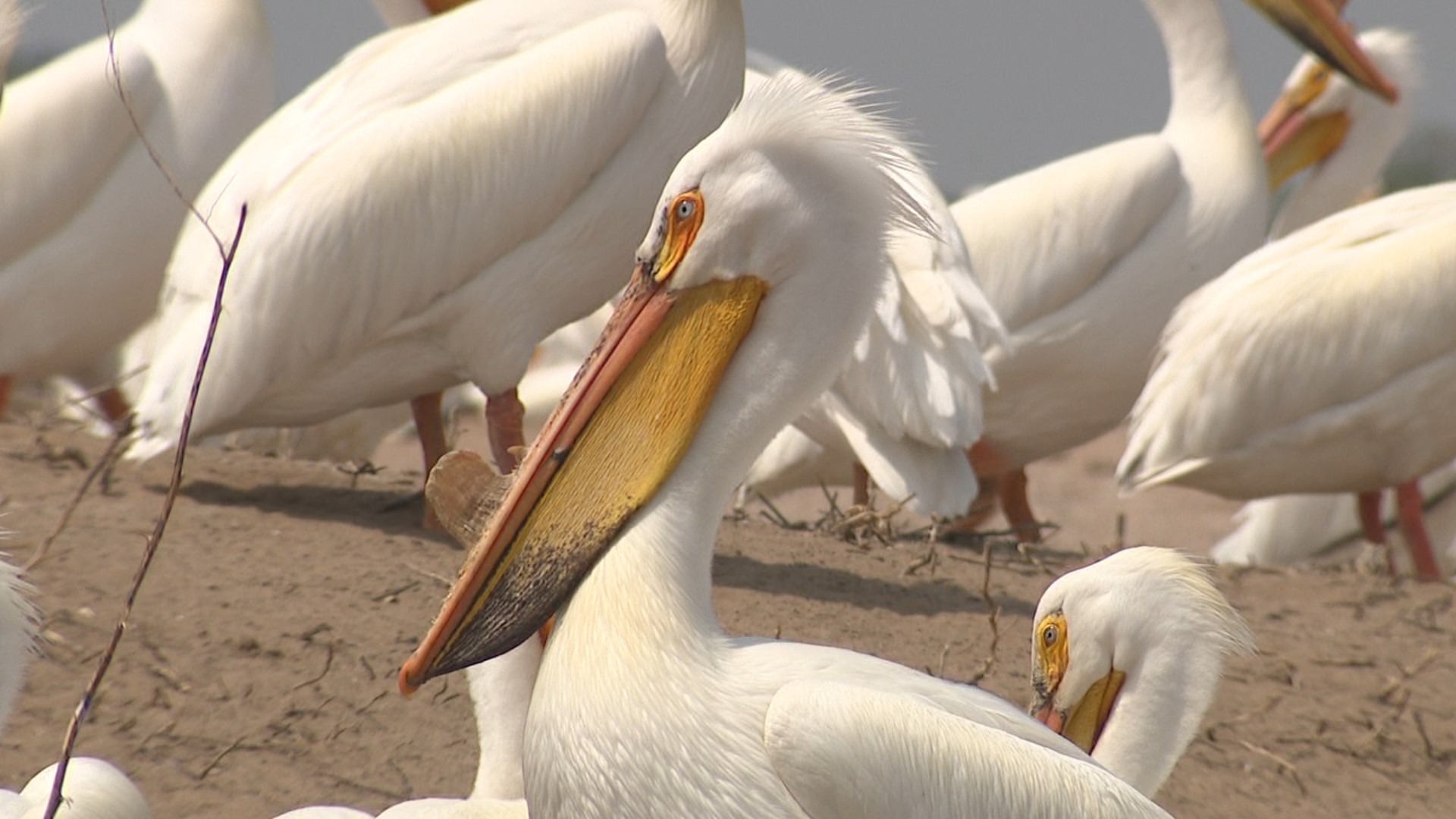
One such island, officially known as Cormorant Island (and colloquially referred to as 'Bird Poop Island') is one of the most popular. Roughly a thousand birds tend to their young on its barren surface, akin to a glorified sand dune, without trees or structures to block out the sun.
"I've checked up and down the river and it's kind of unique. We don't really understand why they're here," Britton said. "But they're such majestic birds."
Today, the local nesting colony has ballooned into the thousands. Pelicans stick together in large groups, often sharing their nesting spaces with varieties of herons, egrets, geese, and more.
"They used to come in late April and leave by early October, but now they're coming in March - as soon as the ice comes out - and they're staying until November," Britton said. "So I think they found a home that they like."
Up close, the birds were wary of our News 8 cameras and reporters, but still curious. With 10-foot wingspans, billowing beaks, and a nasty method of repelling unwanted visitors (pelicans will vomit if you get too close), the prehistoric-looking creature can be intimidating. Still, the giant birds also attract countless visitors and onlookers to the river every year.
Over the years, the wildlife refuge has also helped put up and maintain a webcam on one of the nesting islands in partnership with the Stewards of the Upper Mississippi River Refuge. You can check in on the birds via that camera, here.
"They're really a pretty bird," Britton cooed, as he boated up to one of the main nesting islands. "A lot of folks come to the river to see pelicans."
However, the pelicans' river homes are being threatened a little more each year.
"Now, because of the lock and dam system, the high water levels, and particularly the high flows, wind and wave velocity, it's eroded much of the area," Britton said.
Increasing amounts of flooding and severe weather, including the devastating 2019 flood, have chipped away at the birds' islands.
"At least half an inch per year of silt is growing underneath the water," Britton said. The refuge has also noticed increased sedimentation along the shorelines, leaving the river's islands to take the full force of the wind and waves.
"And they're all sand so if they don't have any riprap protection, they typically won't survive out here," Britton said.
In fact, two of the islands the pelicans had been nesting on have already been lost to the elements.
"Woodroves Island was a much larger island that was probably five times larger and full of trees," Britton remarked. "Now just a couple of limbs are all that's left. That's typical of what's happened to the islands out here."
Another popular pelican post was Gomers Island. But today, all that's left of the once bird-covered mound are a few tree limbs breaking above the waterline.
To help, the refuge has been working with the U.S. Army Corps of Engineers to create protected islands for the birds. In fact, it's how one of the pelicans' favorite nesting spots came to be.
"This is actually called Pelican Island and you can see why," Britton laughed, pointing out a small island covered in nearly a thousand giant, white birds. "In 206, this was built by the Army Corps of Engineers."
When the corps dredged a nearby part of the main river channel, thousands of cubic yards of sand were pumped three miles south, to create the horseshoe-shaped island. Riprap was then placed all around the base of the mound, protecting the sand from wind and waves.
"Without some type of riprap protection for the sand islands, they're not going to make it in the future of this river," Britton said.
In that case, the birds would either have to move on to a new nesting ground or risk the predators lurking along the shorelines.
"There's a lot of dredge material. So this was one way to beneficially use it to provide a wildlife habitat," Britton said.
Now, the hope is to continue finding creative solutions to the pelican's problem, in order to keep these birds of a feather flocking together, right in the middle of the Mississippi River, for many years to come.