
DAVENPORT, Iowa — Davenport Public Works announced it's seeking input on its proposed flood resilience concepts. The city spent nearly 18 months gathering data and stakeholder and community input to put together this plan for new flood mitigation efforts.
"We wanted to make sure that we didn't come to the public one time and ask for a set of opinions on a whole host of options, and come back and say, 'Hey this is what we're doing,' or 'This is what we're presenting to the elected officials,'" said Assistant Public Works Director, Clay Merritt.
Those will live either both in and outside the Mississippi River floodplain are asked to complete an online survey with feedback to help guide Davenport through the final phase of the city's flood study.
Those interested in completing the survey are asked to watch a 22 minute presentation to learn more about the proposal. The survey itself takes around 30 minutes to complete.
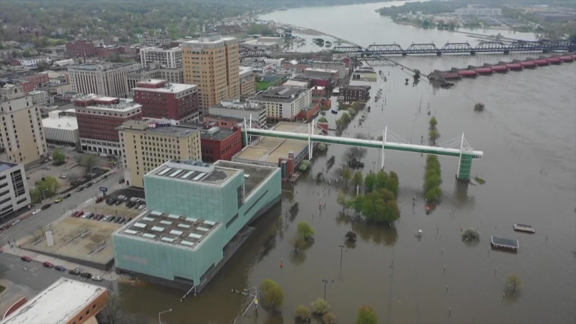
The proposal specifically targets flood mitigation efforts for higher level floods at 18 to 22 feet. At stage 18, LeClaire Park is underwater and the water is touching parts of River Drive. The Mississippi River reached its historic crest at 22.7 feet on May 2, 2019. Right now the river is only at 4.4 feet, so flooding isn't a current concern.
The flood mitigation plans will help the city to delay when it needs to start flood fighting, ultimately spending less money on it. The goal is to create more permanent solutions, something that the city said they learned was important based on initial feedback, and to allow the public to have more access to the city up until the highest flood stages. One of the long term impacts will be establishing a permanent detour route across Davenport that will remain open up to a flood at stage 22.
The proposal breaks Davenport down into four different areas: Village of East Davenport, 4th to Gaines Street, Gaines to Division Street, and West Davenport and Credit Island.
They're focusing on four types of mitigation efforts: underground, flood wall, raised road and landscape berm.
Highlights of the plan include:
- Sewer improvements and replacing temporary pumps with permanent ones
- Elevating a 1,600 foot stretch of E. River Drive by three feet east and west of Mound Street
- Elevating parts of LeClaire Street by one-two feet from north of the railroad past 3rd Street
- Building landforms and floodwalls into existing berms from areas under the Arsenal Bridge and the railroad down to Veteran's Memorial Park
Improvements could cost anywhere from $99.2 million to $150 million dollars, and take one to ten years to build.
Davenport Public Works is hosting two booths this weekend where the public can comment or ask questions about the proposal. On Saturday, Aug. 28, they'll be at the Freight House Farmer's Market from 8 a.m.-1 p.m. and on Sunday, Aug. 29, they'll be at the QC Empowerment Open Air Market from 4-7 p.m.
The survey will stay open until Sept. 15 and Public Works expects to present the finalized proposal to Davenport City Council in mid-November.