
Our pattern this week is relatively quiet, but unfortunately, that doesn’t mean this thick cloud cover will be going away anytime soon. In fact, some patchy areas of fog Sunday night into Monday morning will only further enhance the clouds as we start the new work week.


Visibility is expected to be impacted across much of the region for Monday morning and even a few slick spots are possible, especially on elevated surfaces. Visibility will improve by the mid-morning hours of Monday with mostly cloudy skies sticking with us for the remainder of the day.

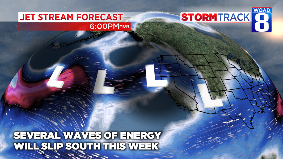
The reason for all of these clouds sticking around is a fairly active jet stream situated just to our south. As several impulses of energy follow this jet stream, the clouds associated with these storm systems will continue to remain locked in place. We’ll also see thicker clouds thanks to the melting snowpack throwing additional moisture into the air this week as temperatures slowly rise above freezing during the day.

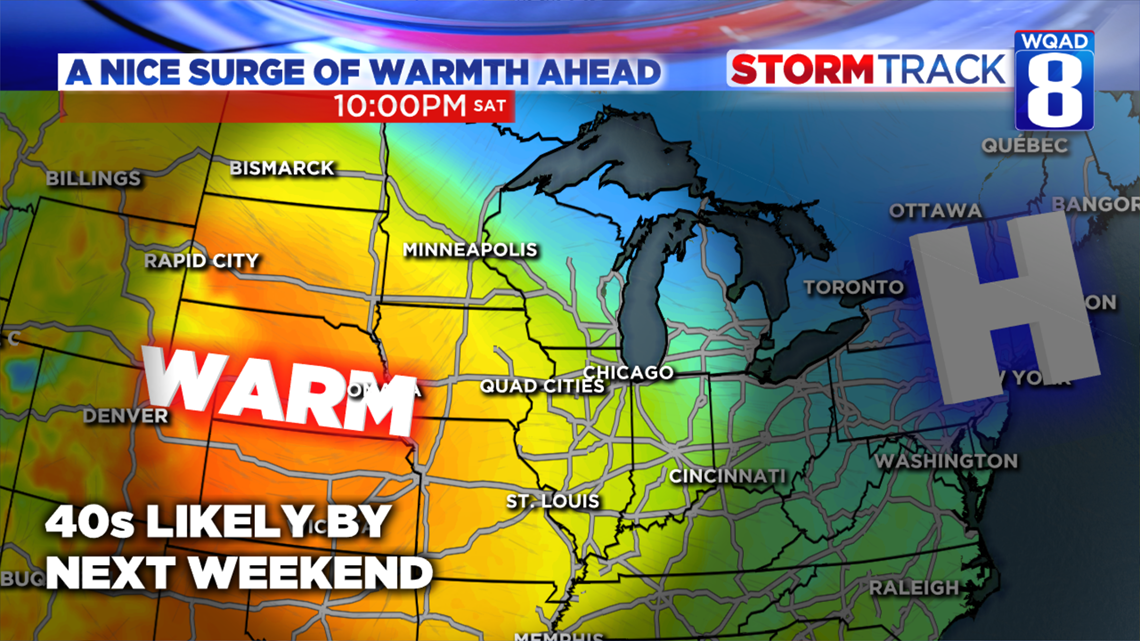
It’s not all bad news, though. By next weekend some sunshine will finally stick around for a while as temperatures begin to surge above normal for this time of year, the lower 30s. A pattern change will bring back a south wind by the weekend and that will help push our high temperatures into the 40s. So far, it doesn’t appear any systems will interrupt that warmth for the weekend itself, but by week two into February, we’ll likely begin to see this pattern break down and introduce more rain and snow chances back into the forecast.

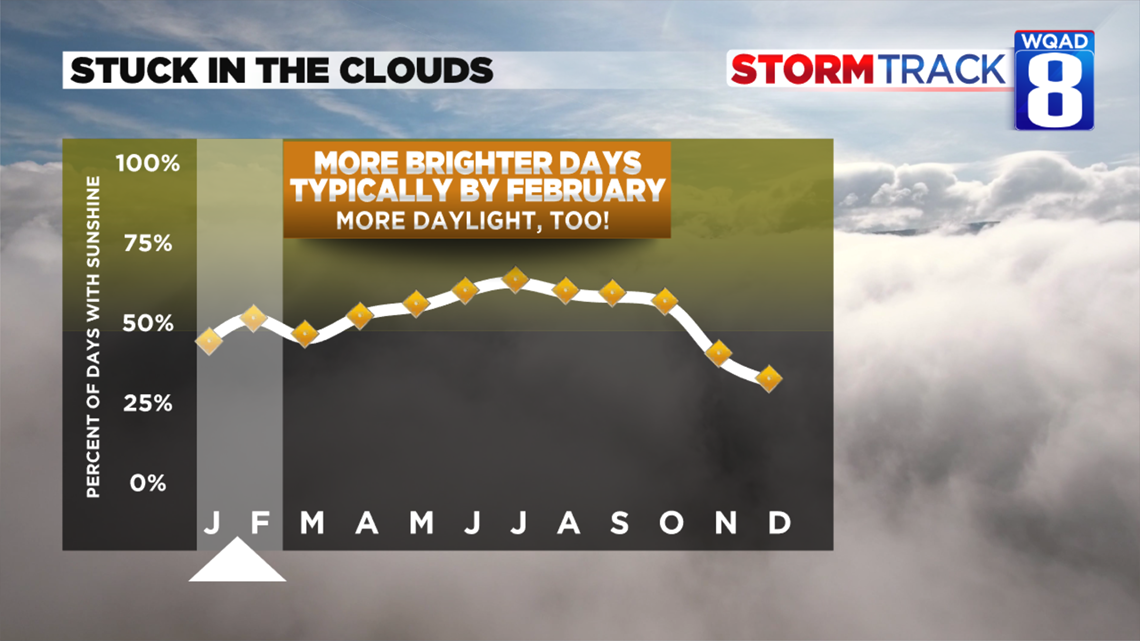
Several cloudy days are fairly typical this time of year. While it isn’t the lowest point in terms of days where sunshine is observed, it certainly isn’t the highest either. By February we actually see a nice spike in the number of brighter days featuring sunshine and that trend only continues to climb as we head into the spring, despite a setback in March as the seasons begin to transition.
Don’t forget, we are also adding more daylight, too. You’ve probably already noticed that we still have a little bit of daylight to work with after 5pm. That will continue to grow in the weeks ahead and we’ll see a nice boost once we hop back on to Daylight Saving Time which resumes on Sunday, March 8th.
Meteorologist Andrew Stutzke