
WHAT A CHILL COMING OUR WAY. Hope you have your autumn clothing attire ready to go. Last week, I saw hints of this and its still in the cards for later this week. A big high off British Columbia and a building block over Greenland, drops the polar jet stream across the entire Midwest.

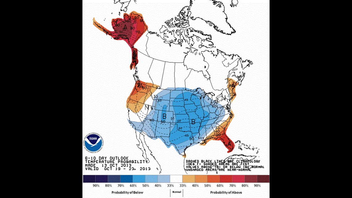
The deepening trough will a create persistent northwest wind flow aloft. This large buckle in the jet stream will steer air into the region from the Canadian arctic sending temperatures well below normal through the weekend.

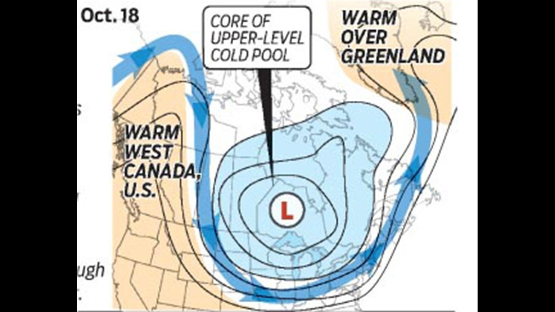
In the long term, there have been signs that the core of this arctic air may drop a series of these cold waves heading into the winter season. Now, when will one of these waves deliver our first snowflake. Stay tuned. It may be sooner than you think. 🙂