
MOLINE, Ill — Hi Folks!
Pretty quiet in our skies, and we should be able to keep it that way as we go through the rest of the afternoon with temperatures expected to reach into the 80s.
A stalled boundary to our south may provide an isolated shower or thunderstorm overnight. Otherwise, skies will remain partly to mostly cloudy with lows dropping around the warm mid 60s.
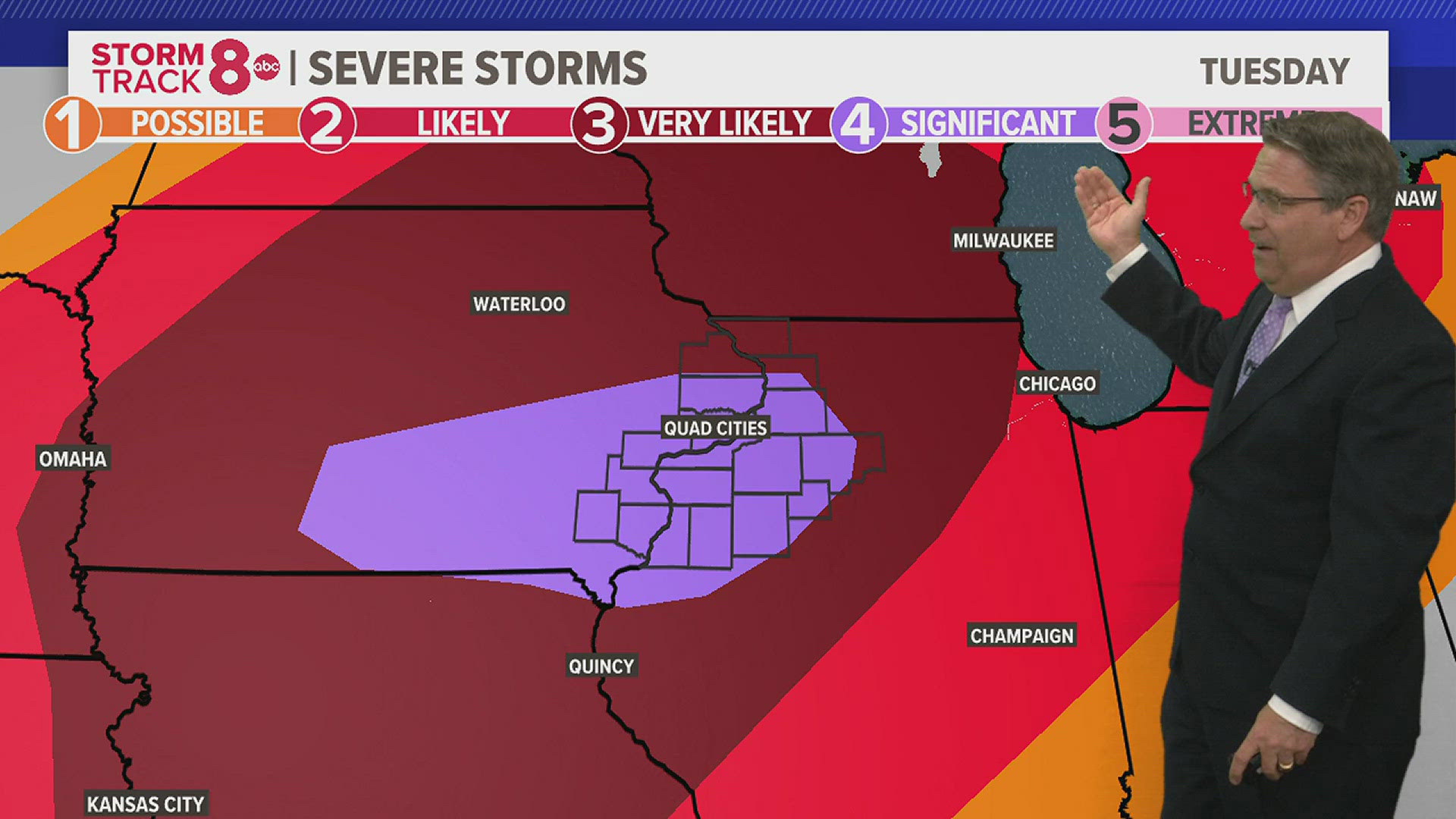
By Tuesday is when we need to plan and prepare for the likelihood of severe weather. They'll be plenty of warm and humid to play with as highs climb well into the 80s.
The storm activity will come in several waves. The first may graze a few counties to our north by in the morning. A slightly larger cluster of storms will move in by the early afternoon hours before the main line associated with a cold front drives its way across the area by the evening hours from 6-9pm.
All modes of severe weather are in play with the high threats being high wind and a couple of tornadoes. The threat will quickly come to an end after 9 pm.
Make sure you have a way to receive weather alerts as well as having a flash light fully charged should power be lost at your household.
Calmer skies take over for both Wednesday and Thursday before shower and thunderstorm chances return for the later day hours starting Friday.
-Chief meteorologist James Zahara


Follow the StormTrack8 weather team on social media: