
A colder temperature pattern looks to stick around for a while as periodic areas of high-pressure move across the Midwest.
While this is good news in that it will limit the chances of any significant storm systems forming this week, it isn't good news in that temperatures will take a major nosedive by the end of the week.

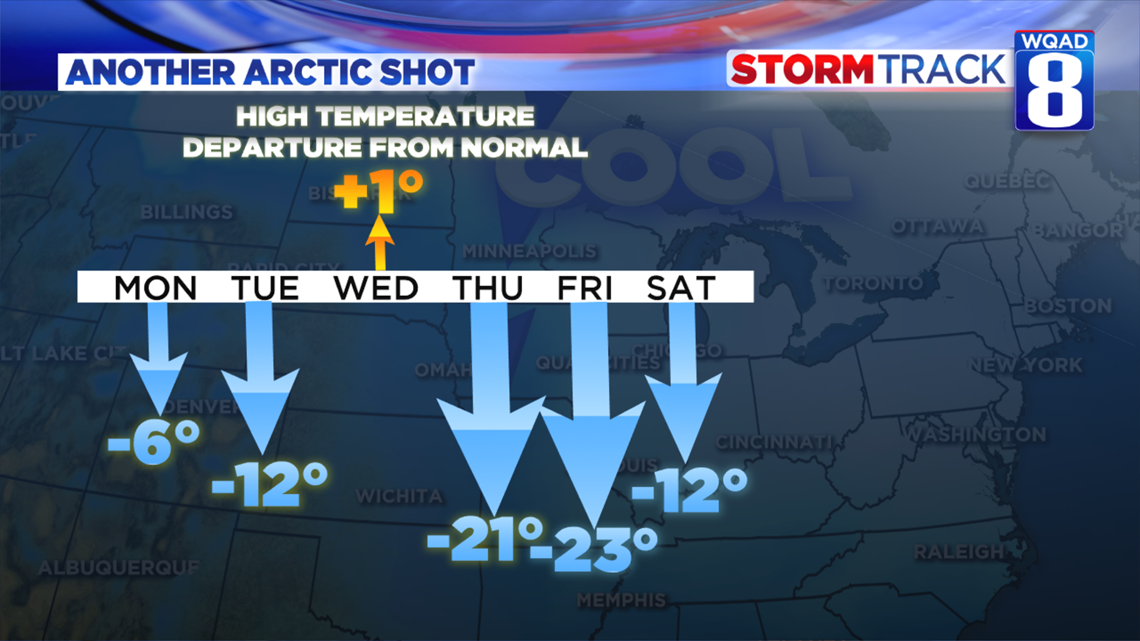
We will only see one day with high temperatures reaching above the norm for this time of year which is in the middle 50s. Some significant calls will lie ahead, especially by the end of the week as a strong area of Arctic high pressure settles into the region.

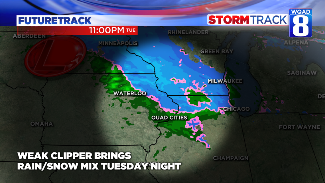
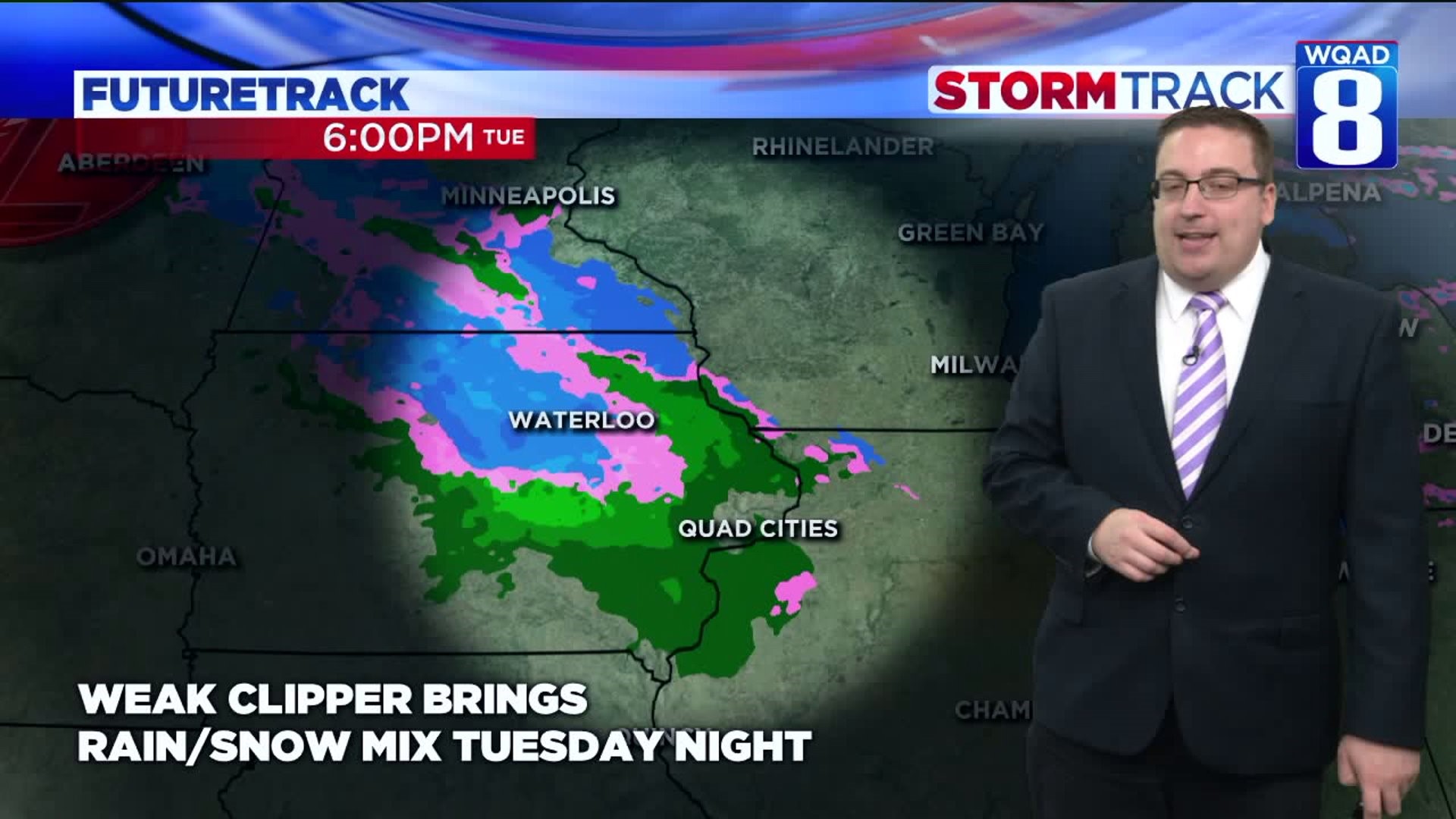
There will be on disturbance worth watching this week and that arrives Tuesday night into the very early morning hours of Wednesday morning.
A weak Alberta Clipper, named that because this type of fast-moving storm system develops in Alberta, Canada, will streak across the region during this time frame. Areas of light rain mixed with light snow will become likely after dark Tuesday evening, ending shortly after midnight Wednesday morning.
At this time I wouldn't expect much in the way of travel impacts for Wednesday's commute, especially since our temperatures have been above the freezing mark for a good amount of time by then.

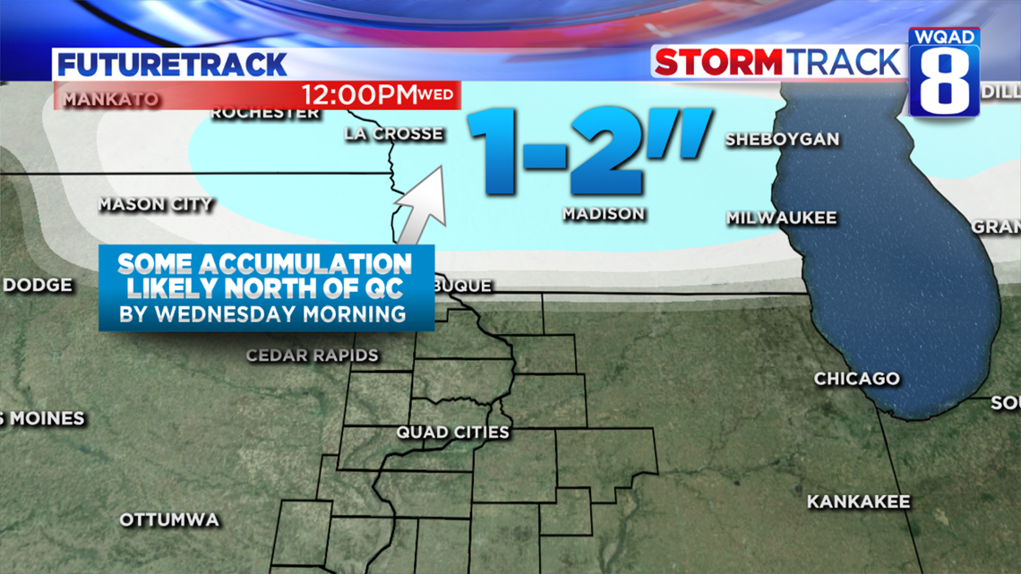
Areas to our north though won't be as lucky.
This system will likely drop some snow accumulation across parts of far northeast Iowa and south Wisconsin by Wednesday morning on the order of an inch or two. Areas near Dubuque, Iowa could also see some light accumulations, mainly around a dusting.
All of the precipitation ends before the morning commute gets underway, so I expect very little in the way of impacts.
Looking further down the road one more storm system will arrive Sunday bringing with it another rain/snow mix. This system will need some fine-tuning in the days ahead regarding any snowfall potential, but certainly, some record-breaking cold looks likely once this system departs.
- Meteorologist Andrew Stutzke