The combination of a warm front moving through the region and some instability will bring the threat for a couple of strong to severe storms this evening.

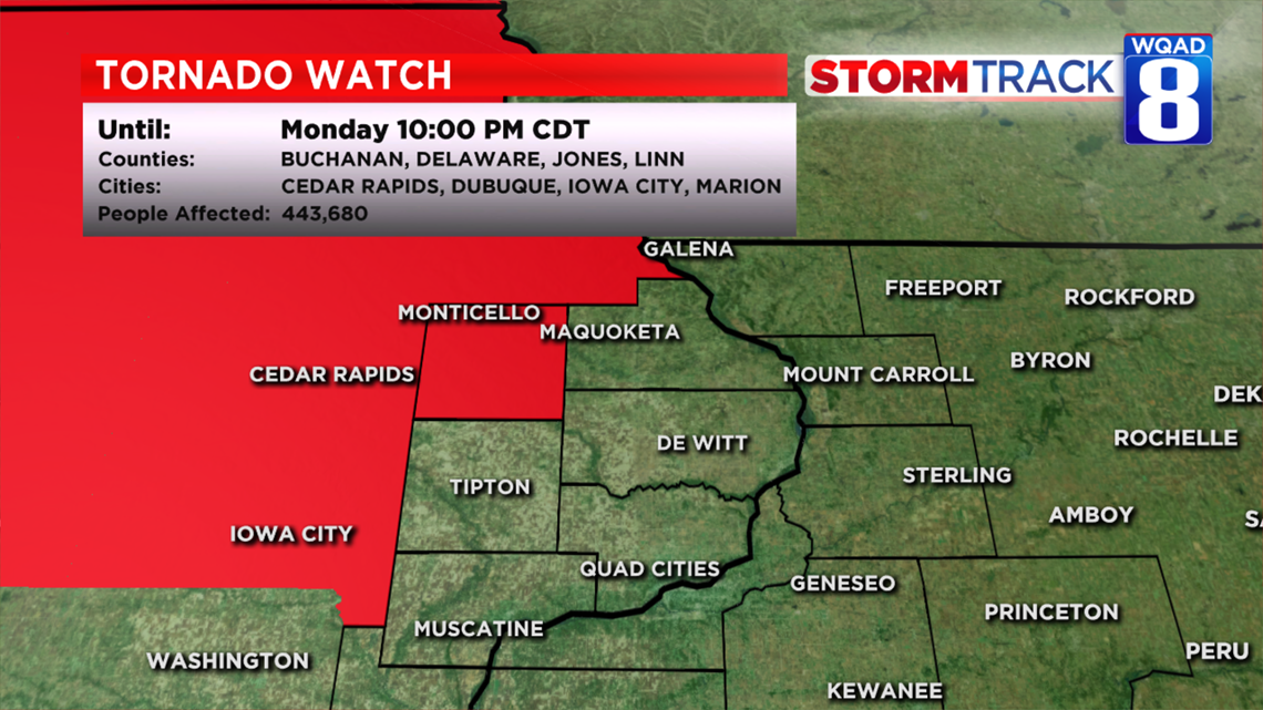
A Tornado Watch has been issued for Jones County in Iowa until 10pm tonight. This watch includes Monticello and much of northeast Iowa. These areas northwest of the immediate Quad Cities will have the highest potential at seeing some of the stronger activity after 6pm this evening.

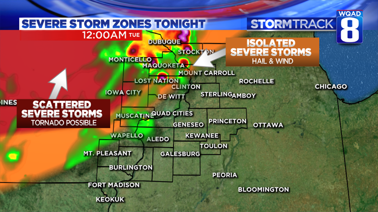
Our FutureTrack model depicts a line of strong to severe storms currently forming over southwest Iowa racing northeast this evening. Areas shaded in red have the best chance at seeing strong storm activity, including large hail, damaging winds, and an isolated tornado or two.
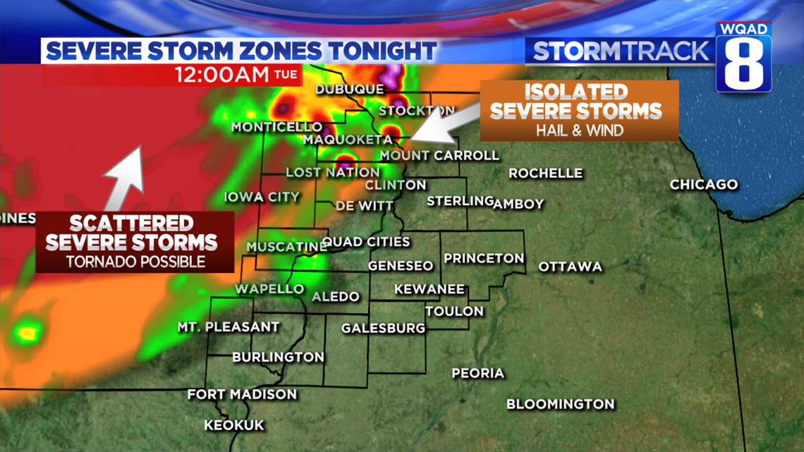
The further east you go the less favorable the overall wind pattern is aloft for supporting severe weather, so only an isolated risk for severe storms exists from Maquoketa to Lost Nation, the Quad Cities, and Mount Pleasant. Storms in these areas will be moving through well after dark and into the early hours of Tuesday morning. Some small hail and gusty winds will be likely with this activity.
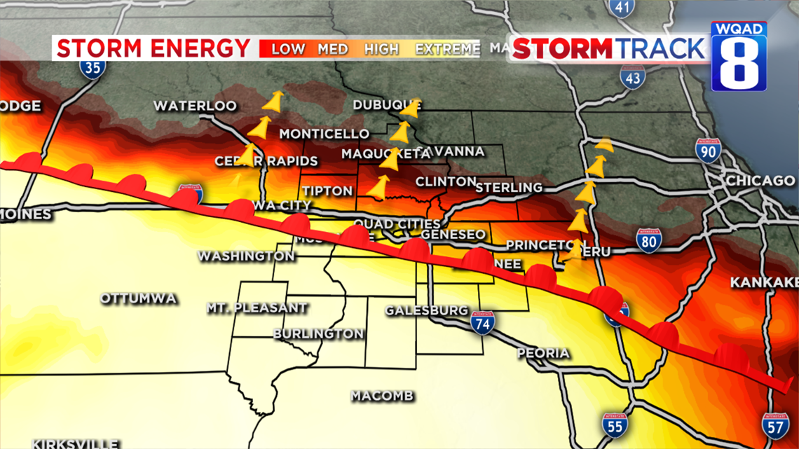
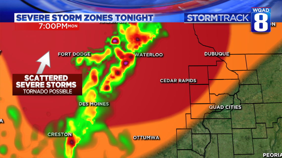
While we have plenty of storm energy available, better dynamics for severe weather are coming together just to our northwest where favorable winds aloft exist. A warm front working northward late this afternoon may fire off a stray storm here in the immediate Quad Cities, but the more intense and widespread activity will take place to the west.
You’ll certainly notice an increase in the humidity by this evening as the warm front lifts north. The severe threat will be over after 10pm with a stray shower or thunderstorm possible area-wide through the overnight hours.
We’ll continue tracking the storms in Iowa as the head east and provide further updates as necessary.
Meteorologist Andrew Stutzke
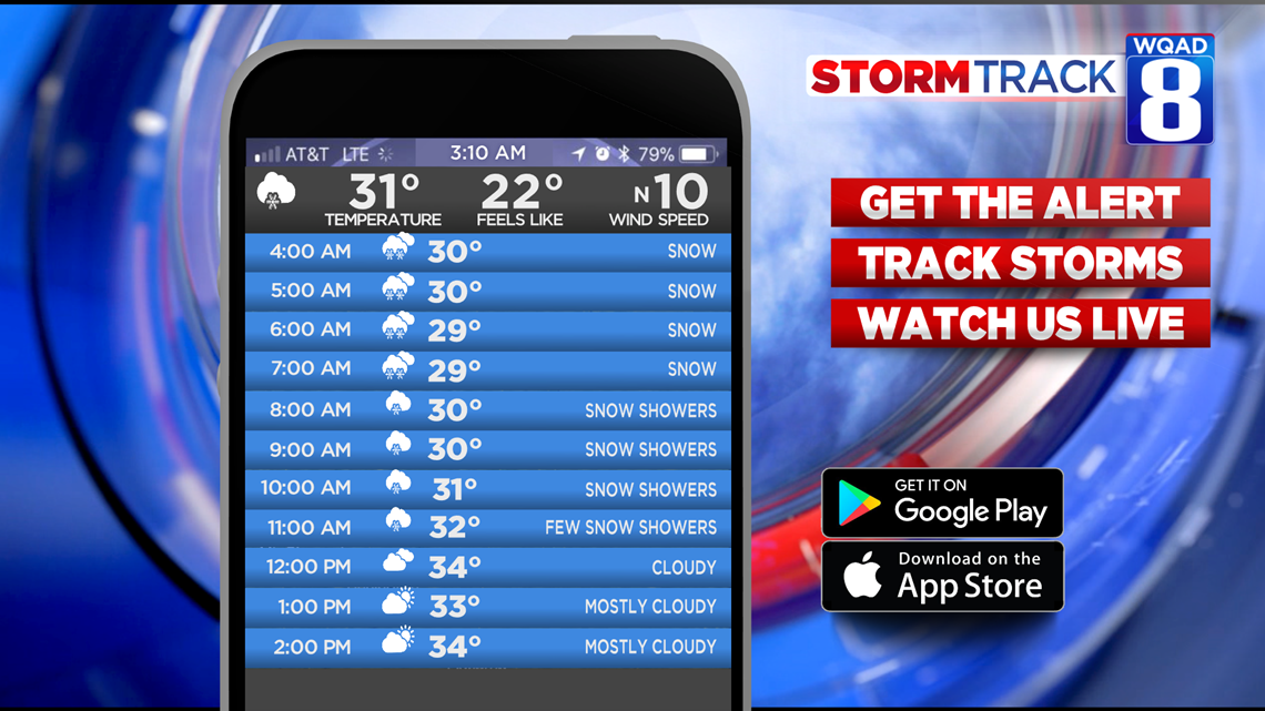
Here’s a look at the hour-by-hour forecast from the StormTrack 8 Weather App:

Click on the links below to download our free weather app: