
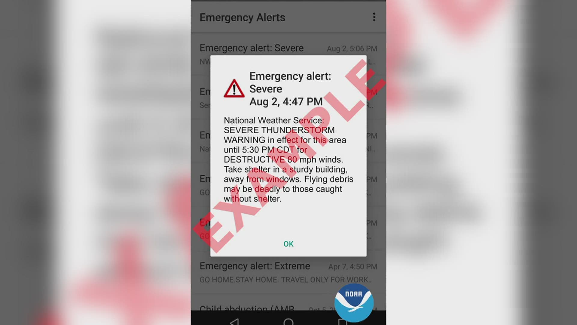
DAVENPORT, Iowa — The National Weather Service announced it's expanding its alert warning categories to include destructive, severe thunderstorms, beginning Aug. 2.
A destructive thunderstorm is defined as having winds over 80 miles per hour and/or hail at 2.75" in diameter (the size of a baseball). Last summer's derecho would be part of this category and people in the affected area would have gotten the alert.
Currently, the National Weather Service sends out a Wireless Emergency Alert (WEA) for flash flood and tornado warnings. This push notification is activated on all smartphones in the affected area, and is how the new thunderstorm alert will be sent out.
"In extreme weather, as we saw during the derecho, you can have outages," said National Weather Service Warning Coordination Meteorologist, Rich Kinney. "We had weather radio stations that went off the air temporarily due to the extreme wind, so you always kinda need a fallback to keep you safe."
The goal is to help people distinguish between a high-impact and a low-impact event, and to have a better way to convey to the public when there's a need for urgent action.
Since the alert gets automatically sent to all smartphones, you don't have to worry about having any sort of weather app.
"This kind of helps fill that gap, if you will, and alert everybody, as many people as possible when these life threatening, severe storms move through," said News 8's meteorologist Andrew Stutzke. "We want everyone to seek shelter, obviously, with knowledge of what's coming towards their direction. If you know that you've got winds of 80 miles an hour and baseball sized hail, that's some serious stuff. And that can certainly kill you if you're caught outside and caught off guard."
The National Weather Service also added a category below the destructive threat tag, called "considerable." It's used for 70 mile per hour winds and/or hail at least 1.75" in diameter (golf ball-sized). The criteria for a "base" severe thunderstorm warning remains the same with 58 mile per hour winds and/or hail 1.00" in diameter (quarter-sized). However, the "considerable" or "base" thunderstorm tags will not active a WEA.
On average, only 10% of all severe thunderstorms reach the destructive category level each year, according to the National Weather Service.
Kinney added that it's important for everyone to have a plan in place for when they do get an alert.
"This time of year, severe weather can develop at just about any time," he said. "We really encourage folks to have a plan, share weather information with your family and friends in an effort to keep everybody safe."