
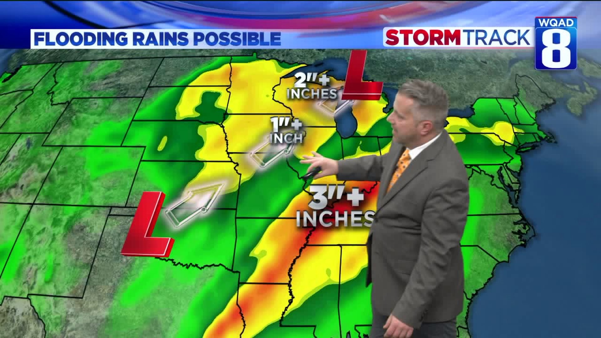
After a few hours of rain Saturday morning, we stand to get at least a few more hours of drier weather for the midday hours. But the heaviest rain is set to move in for the evening and overnight hours.
Check those sump-pumps as we could see a quick inch or two of rainfall! This will be accompanied by thunder at times, although severe weather is not anticipated. Creeks and streams will rise quickly tonight and into the early morning hours of Sunday. Temperatures will rise to near 60 degrees during the overnight.

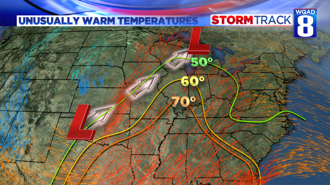
Sunday will actually turn out to be a pretty decent day. Rain and thunder will exit in the early morning with dry skies for most of the day. It will be breezy with winds out of the southwest. But that wind direction is going to be warm! Temperatures will actually remain fairly steady in the middle 50s. Any breaks of sunshine could bring us back up to 60 degrees!
Cold air is set to move in Sunday night with a dramatic drop down to 29 by Monday morning. We could even see a brief rain or snow shower before the start up of our new work week.

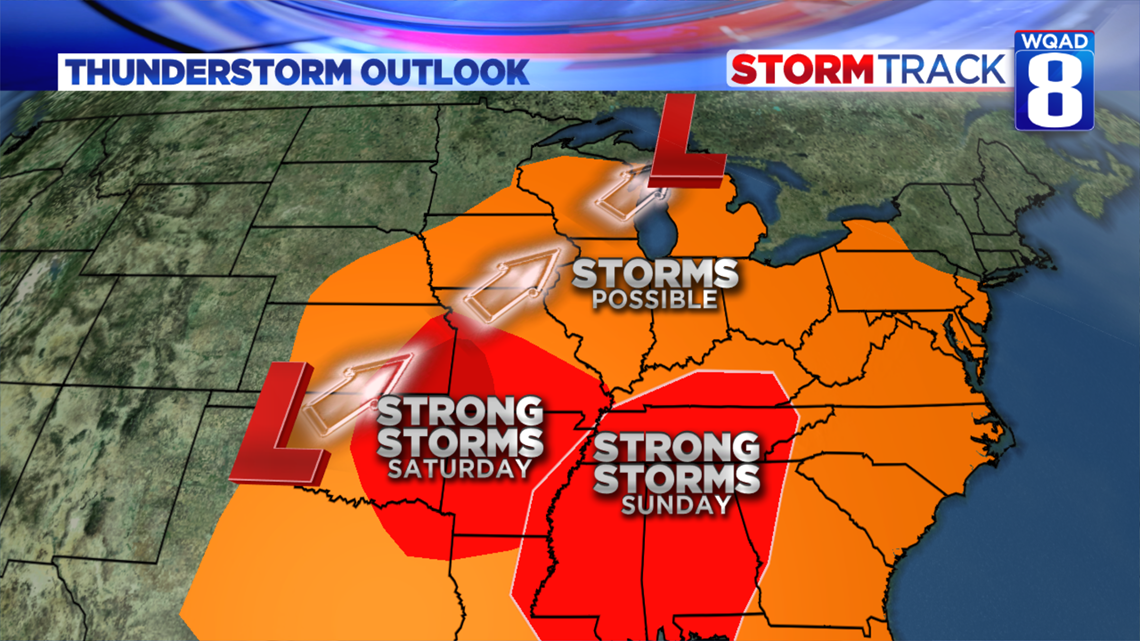
For travelers, be on the lookout for severe storms to our south both today and tomorrow.

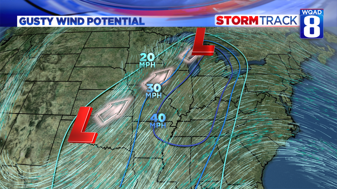
Winds could gust to 40 mph to our east over the weekend.

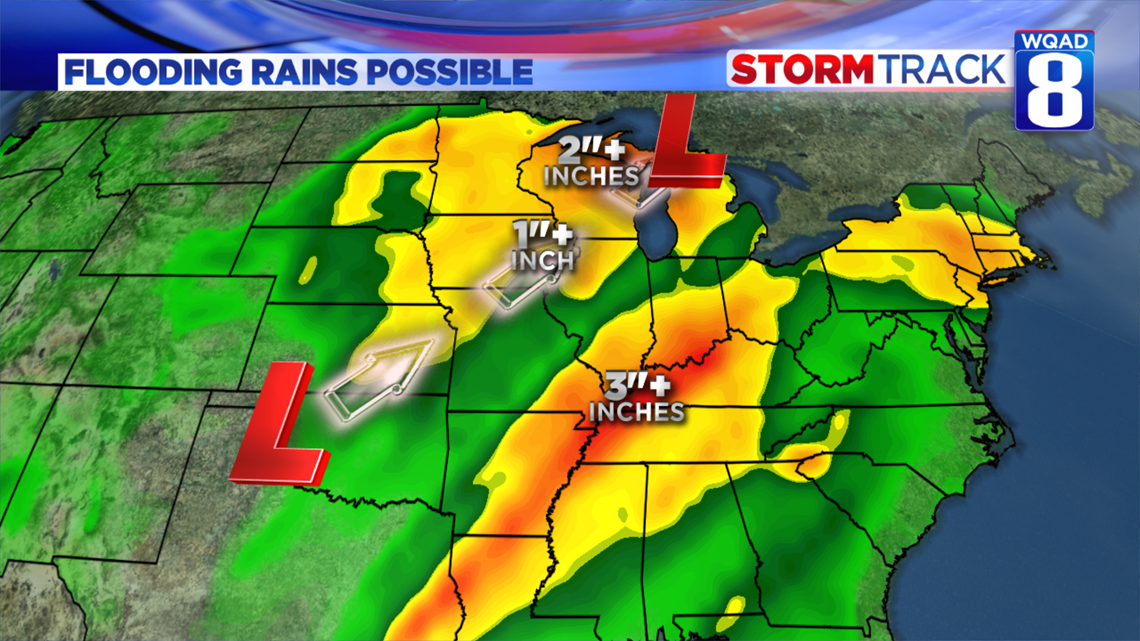
Heavy rainfall could cause creeks and streams to overflow their banks. Rivers could near or exceed flood stage early next week.

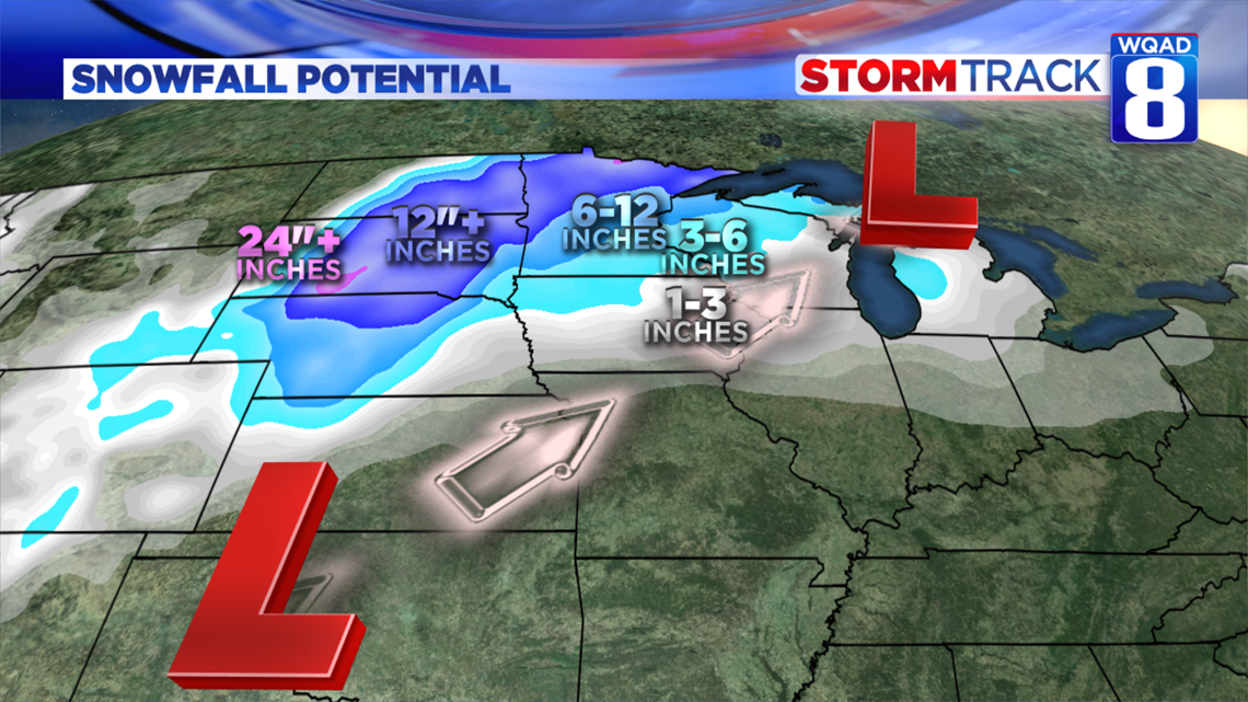
Big snows out in the Dakotas where a few localized places could receive more than two feet of snow!
-Meteorologist Eric Sorensen