This severe weather threat has ended.
-----------------------------------------------------------------------------------------------------------
Thunderstorms and severe weather hit the Quad Cities region. Watch live here:
4:45 p.m. - Severe weather has passed through the Quad Cities area. All counties in the Quad Cities region are no longer under severe weather threats. Pea-sized hail was reported.
4:35 p.m. The storm is headed through Matherville hitting Sherrard in 13 minutes. Hail was reported in Milan, Illinois.
Thunderstorms are going to pass through areas quickly.
4:26 p.m. Rock Island County issues a thunderstorm warning until 5 p.m.
4:15 p.m. - Severe thunderstorm warning issued for Muscatine and Mercer Counties. Warning dropped for Bureau County, Illinois.
3:45 p.m. - Warning issued for parts of Knox, Bureau and Warren Counties in Illinois until 4:45 p.m. Galesburg is specifically seeing seeing severe weather.
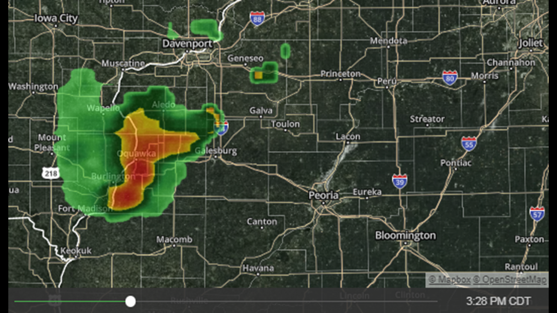
3:30 p.m. Reports of softball sized hail near Denmark, Iowa which is southwest of Burlington.
3 p.m. - Severe thunderstorm warning for Van Buren County in Iowa until 3:30 p.m. as well as Des Moines, Lee and Henry Counties. In Illinois, Henderson County and Hancock County until 4 p.m.
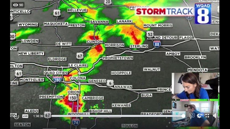
2:45 p.m. - Look at our interactive radar for 3:30 p.m.

2:30 p.m. - A severe thunderstorm warning is in effect for Henry County, Iowa until 3:15 p.m.
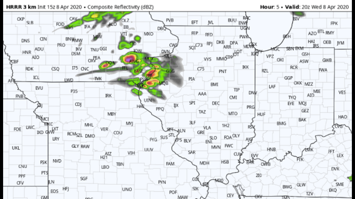
11 a.m. - Models continue to show high confidence of damaging thunderstorms developing over the next few hours in Southeastern Iowa. These storms will move almost due-east, or slightly south of due-east. Damaging hail will be the main threats.

9 a.m. - ThreatTrack Level 2 in place for much of the region today. A strong cold front will sweep through Eastern Iowa and Western Illinois through the early to mid afternoon.
8:30 a.m. - FutureRadar shows a developing area of storms shortly after lunch, tracking along and south of I-80.
Threats will include very large hail again. Storms will become damaging wind producers as the afternoon goes on so that threat will mainly be confined to our Illinois hometowns.