Hurricane season for the Atlantic Ocean officially began on June 1 and it has already shown signs that this year may be a significant one.
Despite the official beginning of the hurricane season, the Atlantic has already had a lot of activity. Experts predict that this will be quite the active year. It's safe to say that 2020 has brought many abnormalities and weather is no exception. This year, tropical storms have already begun on an unusual foot.
In May, we experienced two tropical systems that gained strength to reach Tropical Storm status. The first storm was Arthur, which formed on May 16 far east from Florida. The next was Bertha, which was a unique storm. Bertha rapidly intensified to reach Tropical Storm status on May 27 and made landfall in South Carolina just an hour later.
There have only been four other years on record that have experienced two named tropical systems. The most recent was in 2012, followed by 1951, 1908, and 1887.
So far this year we have seen three named storms.
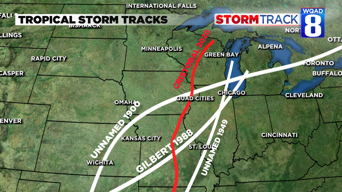
On June 2, Tropical Storm Cristobal formed and, in very 2020 fashion, broke records. Cristobal was the record earliest third named storm. The previous record was Colin in 2016 which formed on June 6. Cristobal even paid a visit to our hometowns!
This isn't entirely out of the ordinary, but it is a very rare occurrence; There are only three other tropical storms that tracked far enough northwest to reach Iowa and northern Illinois.
The last time storm to do this was Gilbert back in 1988 and before that was in the early and mid-1900s before storms were given names. Cristobal's remnants brought about 1.40 inches of rainfall to the Quad Cities, but much heavier amounts were reported to the west of us with the largest nearing 5 inches of rain.

It's safe to say that this year's hurricane season will be one to watch.
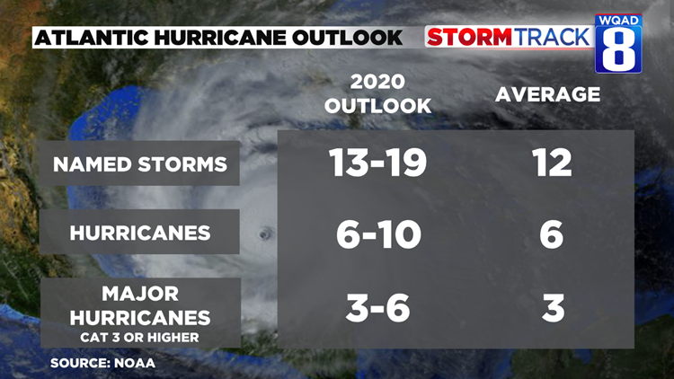
Each year, National Oceanic and Atmospheric Administration (NOAA) forecasters from the Climate Prediction Center and the National Hurricane Center releases a hurricane outlook. This year, experts are predicting a probability of 60% to see an above-average hurricane season. This means we are likely to see more named storms, hurricanes and major hurricanes (category 3 or higher).


Scientists pay attention to a variety of climate factors when releasing outlooks.
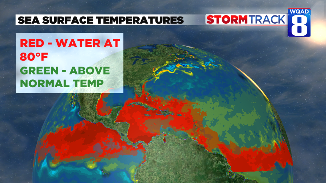
Sea surface temperatures this year have been above average in much of the Atlantic and hurricanes thrive off of warm sea surface temperatures. To intensify, hurricanes need water of at least 80°F. With the above-average sea temperatures, much of the North Atlantic basin has already reached 80°F and is ready to fuel whatever storms travel across.