
Most people in Eastern Iowa and Western Illinois are familiar with "flood stages." According to the United States Geological Survey, a stage is defined as the gauge height of the lowest bank of the stream and when the water begins to inundate different areas within and outside of the flood plain.
Different rivers and creeks have different arbitrary numbers. For the sake of this news story, we are utilizing the river stages for the Mississippi River in Eastern Iowa and Western Illinois.

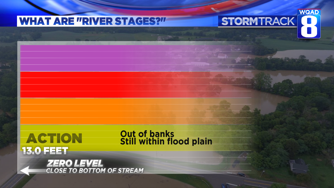
The "zero level" is usually the lowest the river could get. Typically, that is only seen in times of extreme drought.
At 13.0 feet, the Mississippi River reaches its lowest flood stage: action. That's when the river goes out of its banks, but is still within the flood plain.
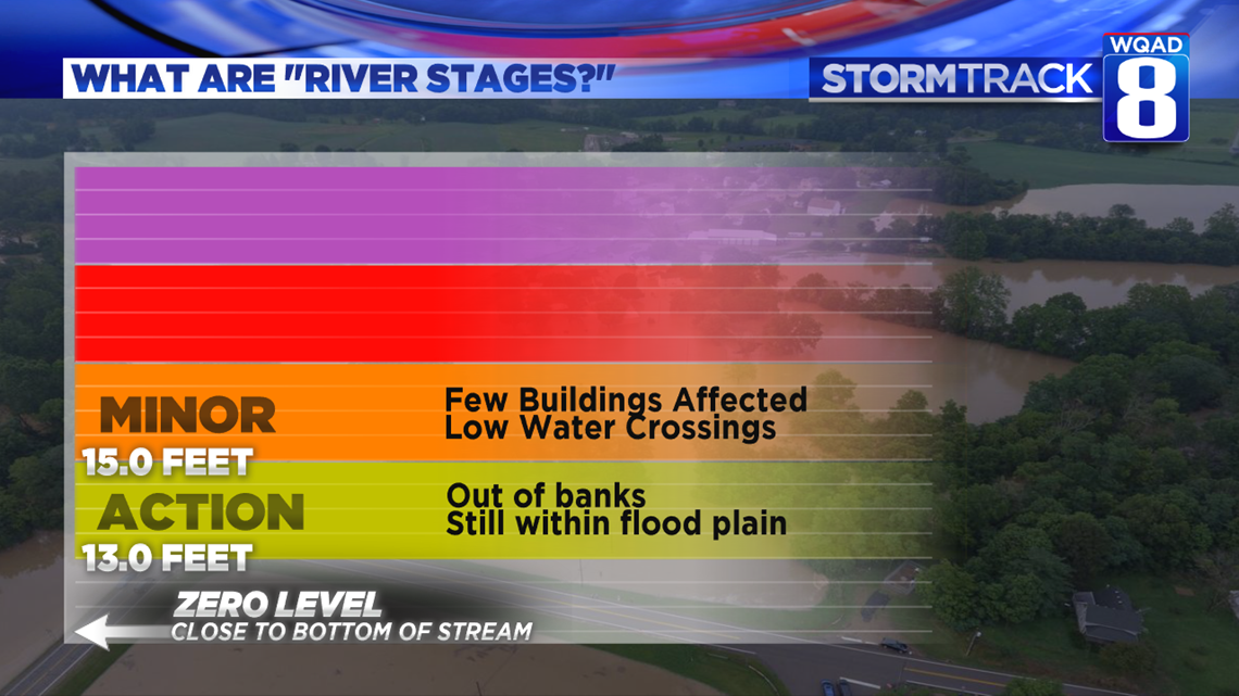
At 15.0 feet, the Mississippi River touches its first buildings. These are usually older buildings, built before flood-zone-codes that prevent new building along the flood plain. Some low-water crossings are impacted, especially in rural locations.

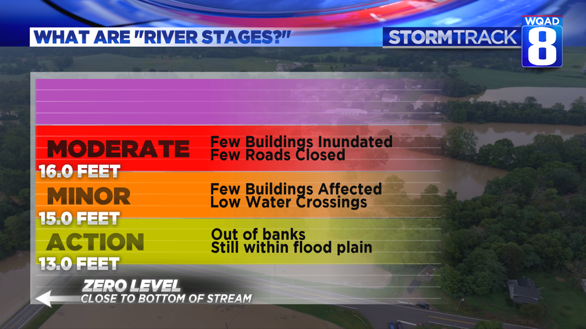
At 16.0 feet, the Mississippi River inundates buildings. More roads are closed.
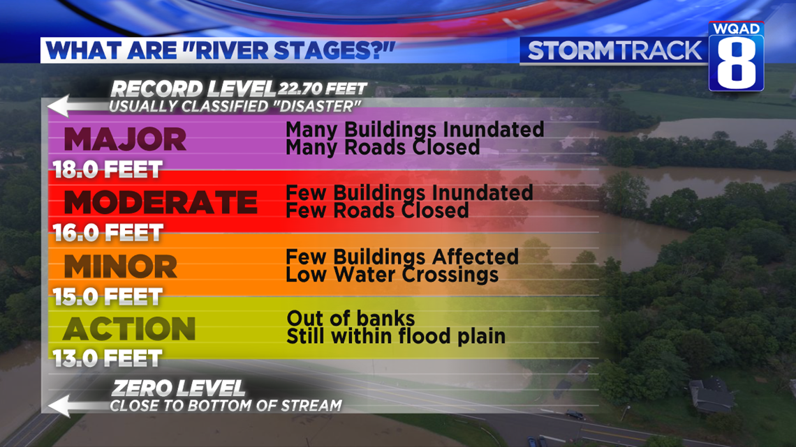
At 18.0 feet, the Mississippi River reaches major flood stage. This is when major thoroughfares are closed. Whole homes and businesses are inundated.
Depending on the location, the Mississippi River reaches its record flood between 21-24 feet. These are usually classified as "disasters" by area governmental agencies.
-Meteorologist Eric Sorensen