
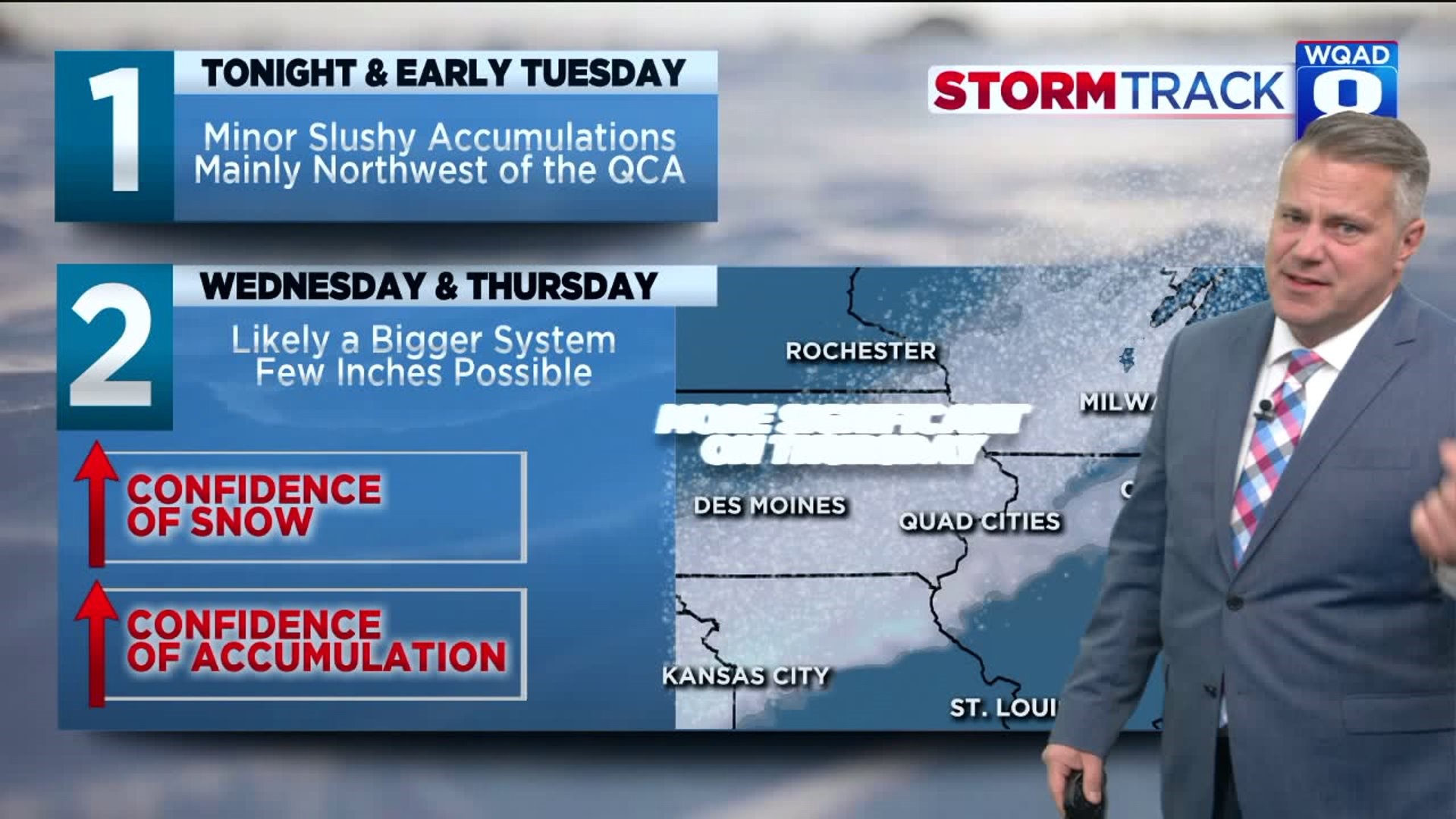

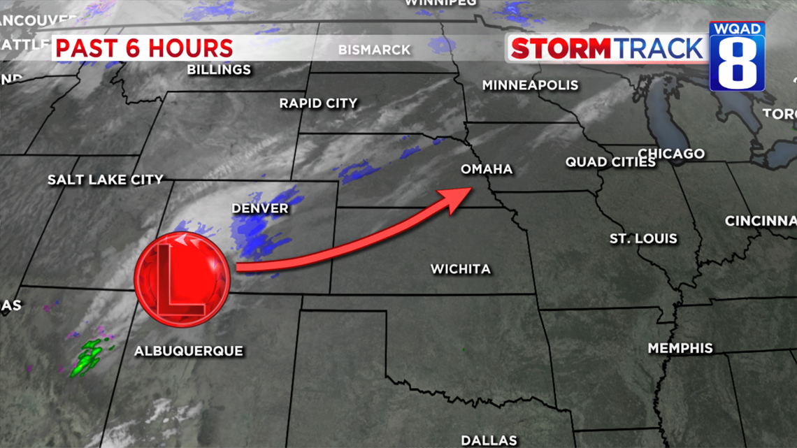
An area of low pressure will move from Colorado into the Mississippi Valley by early Tuesday morning.
At first, we will see a chilly rain with a wintry mix or changeover to all-snow around 10 p.m. Oct. 28, 2019. Wintry precipitation is expected through about 6 a.m., but this will likely be done by sunrise Tuesday morning.

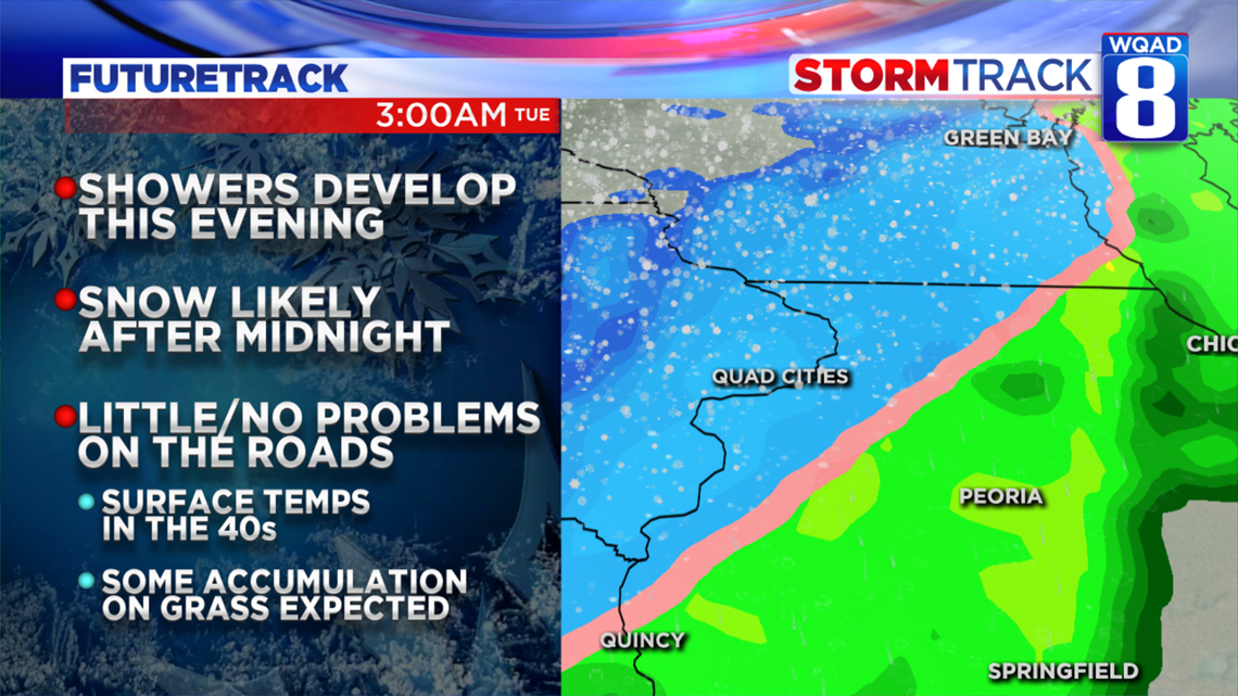
Some accumulations will be possible on grassy areas and decks, but little to no road problems are expected.
That's our "system #1." There's another one we're tracking that will bring more moisture to the area Wednesday into Thursday and yes, that's Halloween.

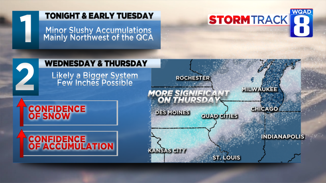
That rain could changeover to snow for a time on Thursday... possibly giving us more accumulation. Our confidence is building that there could even be enough to cause some tricky driving conditions.
We're pretty sure about the timing of the wintry weather, but the amount for Thursday is something that will need fine-tuning. Monday night's shouldn't end up being a big deal.

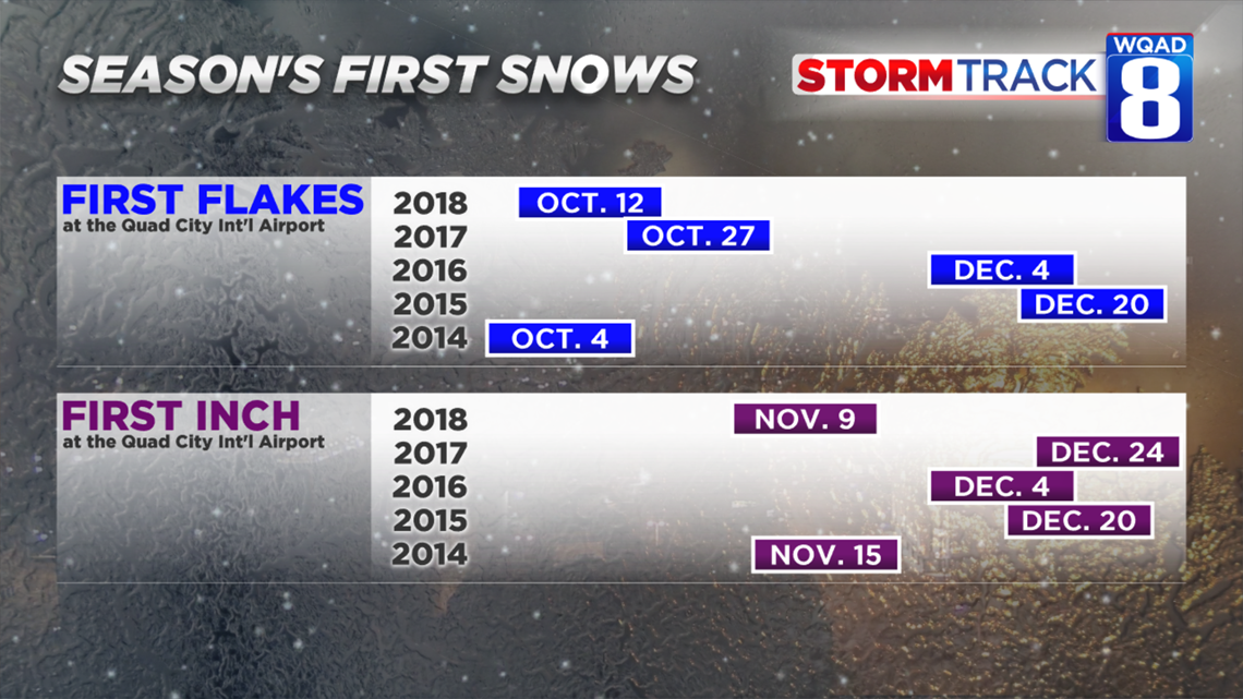
Getting snow this time of year isn't unheard of, however if we get an inch of snow this week it would be the earliest accumulating snow in more than five years!
According to the National Weather Service, we have never had more than a trace of snowfall on Halloween. The greatest amount was just a trace, back in 1954.
-Meteorologist Eric Sorensen