
MOLINE, Ill — Severe weather knows no season here in the Quad Cities. That's evident looking back at past history where we have seen tornadoes in December, January, and even February. March, however, does mark the start of a typically more active time of year when the number of severe weather reports begins to rise dramatically.
The first week in March is designated as Severe Weather Awareness Week in Illinois, a good reminder that we should all have a plan to put into action when severe weather strikes.
Each spring the National Weather Service hosts spotter training sessions, where you can officially become a trained weather spotter. The more eyes we have on the ground watching storms as they roll through, the better. Even with modern technology, radar doesn't always tell the entire picture. With many of our hometowns on the fringes of the best radar coverage, spotters are more important than ever before.
If you'd like to become a National Weather Service storm spotter, click here to register for the online training. Several dates are available for you to choose from and there is absolutely no cost to attend.

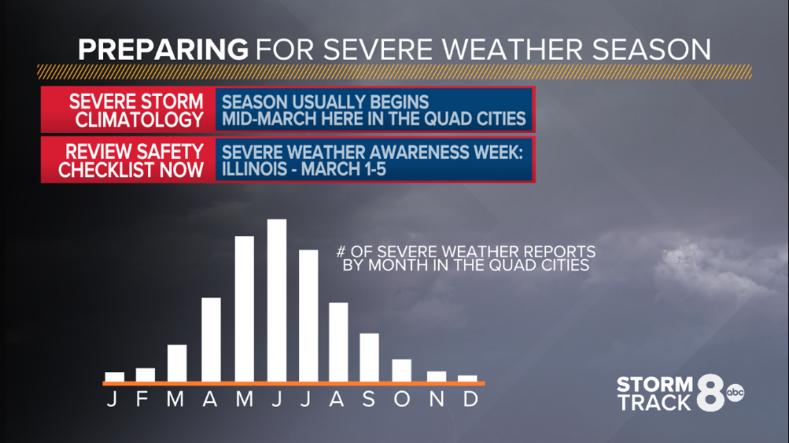
The months of April through July are often the busiest time of year for severe weather in the Quad Cities. As warmer temperatures arrive along with more moisture, storm systems have many more dynamics to choose from when producing precipitation, including strong to severe thunderstorms. As you can see above, our season typically peaks in June.
Let's start with the basics: What is a watch vs a warning?

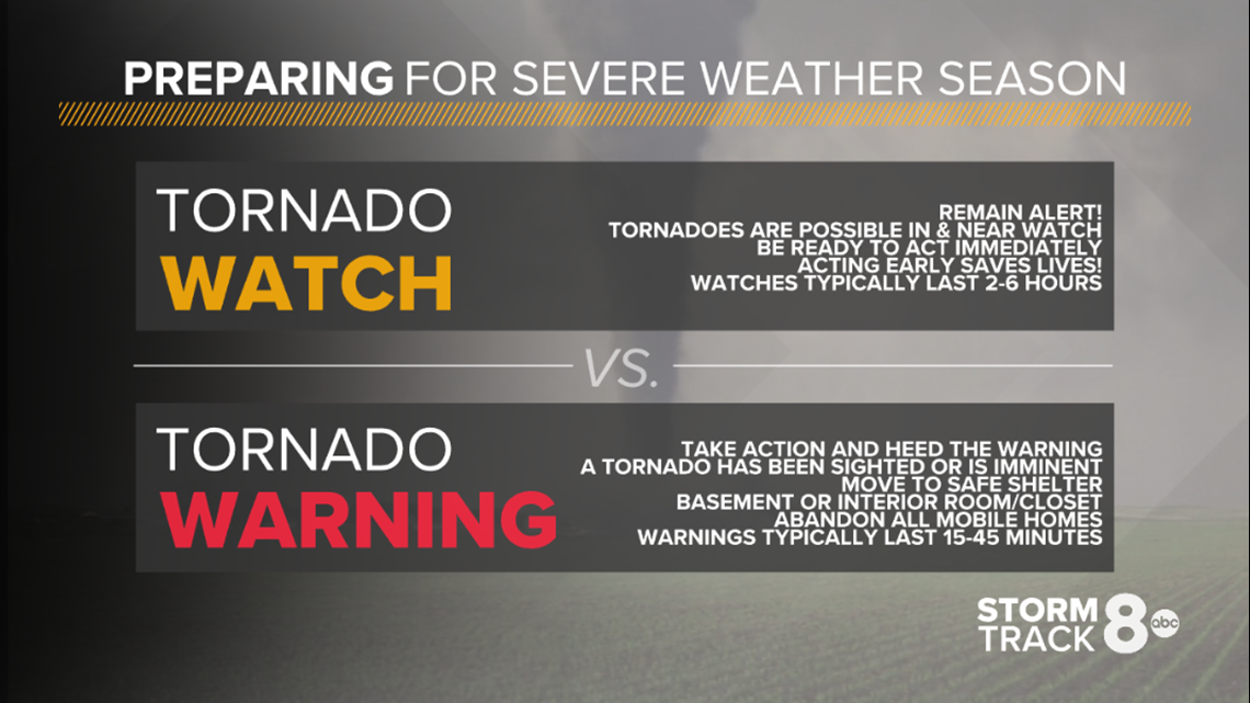
A watch is your advanced heads up that rough weather is anticipated in the next two to six hours. It means you need to have your guard up. Make sure your News 8 app is up to date and functioning with alerts turned on. Do you have a weather radio? Are the batteries in good shape? Is your emergency kit with first aid, flashlights, and non-perishable foods ready to go? You'll want to be ready to take immediate action when necessary.

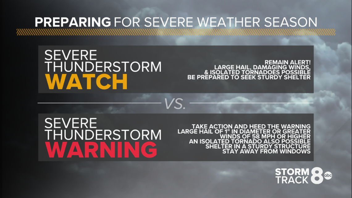
A warning means life-threatening weather is imminent. A Severe Thunderstorm Warning is issued for winds of 58 MPH or greater, and hail of one inch (quarter-sized) in diameter or larger. A Tornado Warning means an actual tornado has been spotted or Doppler radar indicates that conditions are right for a tornado to develop at any moment. When you are placed under a warning, immediate action needs to be taken to protect yourself.
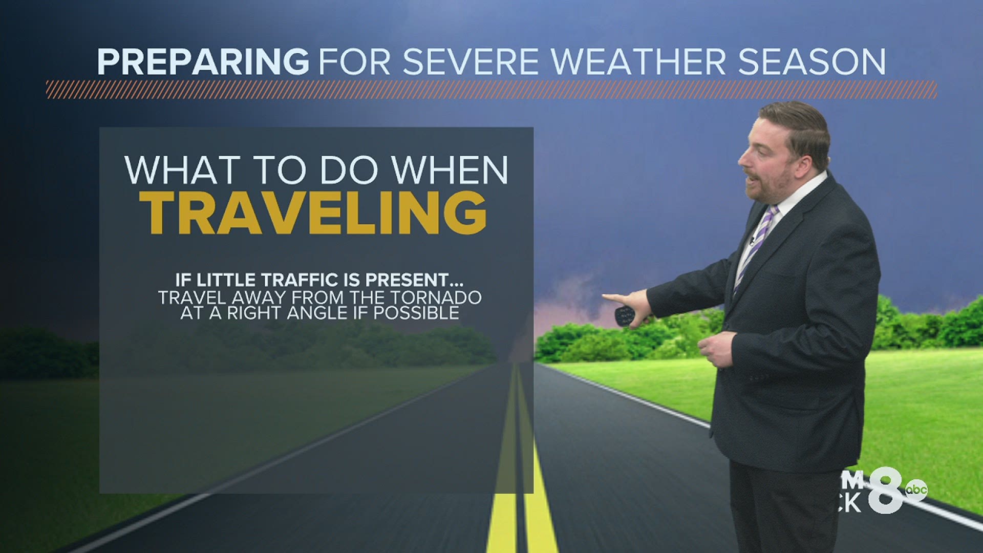
Traveling in your car? The advice depends on your situation. If you can't easily escape the path of an incoming tornado, it's best to abandon your vehicle and seek safe shelter in a ditch or low-lying area. Why not remain inside your car? Think about the size of your vehicle. It has much more surface area. More places for flying debris to hit and penetrate, injuring yourself and others inside. Your vehicle could also become airborne, which carries with it a very low chance of survival.
You can see more severe weather safety information and learn how we forecast severe weather events by checking out Day 15 of Storm Track 8 University.