
MOLINE, Ill. — A small taste of winter has prompted many folks to wonder what the upcoming season has in store for us here in the Quad Cities. Will it be a harsh winter featuring polar vortexes and a ton of snow? Or, more mild winter with seasonal snowfall?
The biggest influence this winter will be the presence of a moderate La Niña. What does that mean for the Quad Cities? Let's dig in.
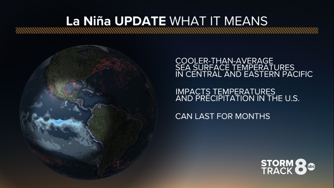
What exactly is La Niña?
It's all about the sea surface temperature pattern in the central and eastern Pacific oceans. These temperature patterns help dictate what weather patterns will set up across the United States and other parts of the world, especially during the colder winter months as the trade winds are impacted. The pattern can and typically does last for several months at a time and impacts not only temperature trends but precipitation trends as well.

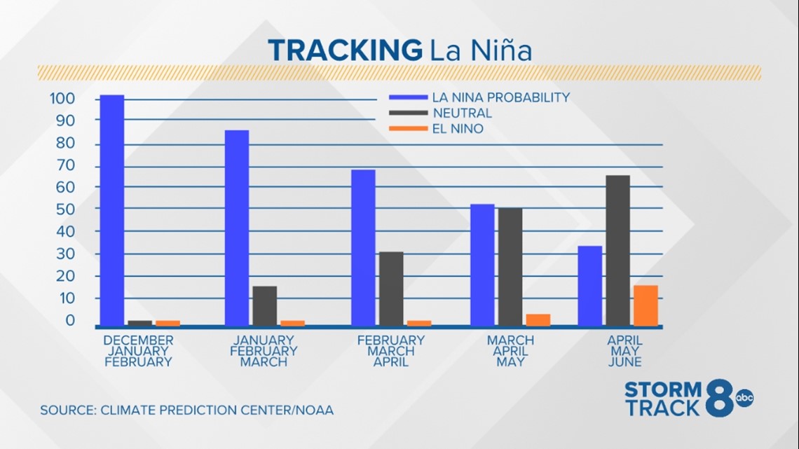
Forecasters as the Climate Prediction Center continue to forecast La Niña conditions through this winter season and into the first part of spring 2022. Neutral conditions are forecast to return by late spring. Looking at the forecast chart below, it's easy to see that La Niña clearly wins this forecast cycle, with multiple months having probability numbers greater than 50%.

We haven't seen much in the way of snow so far this month of December, that doesn't mean the rest of winter will be as gentle. La Niña patterns are notorious for producing some healthy snows in the Midwest, especially the upper Midwest.

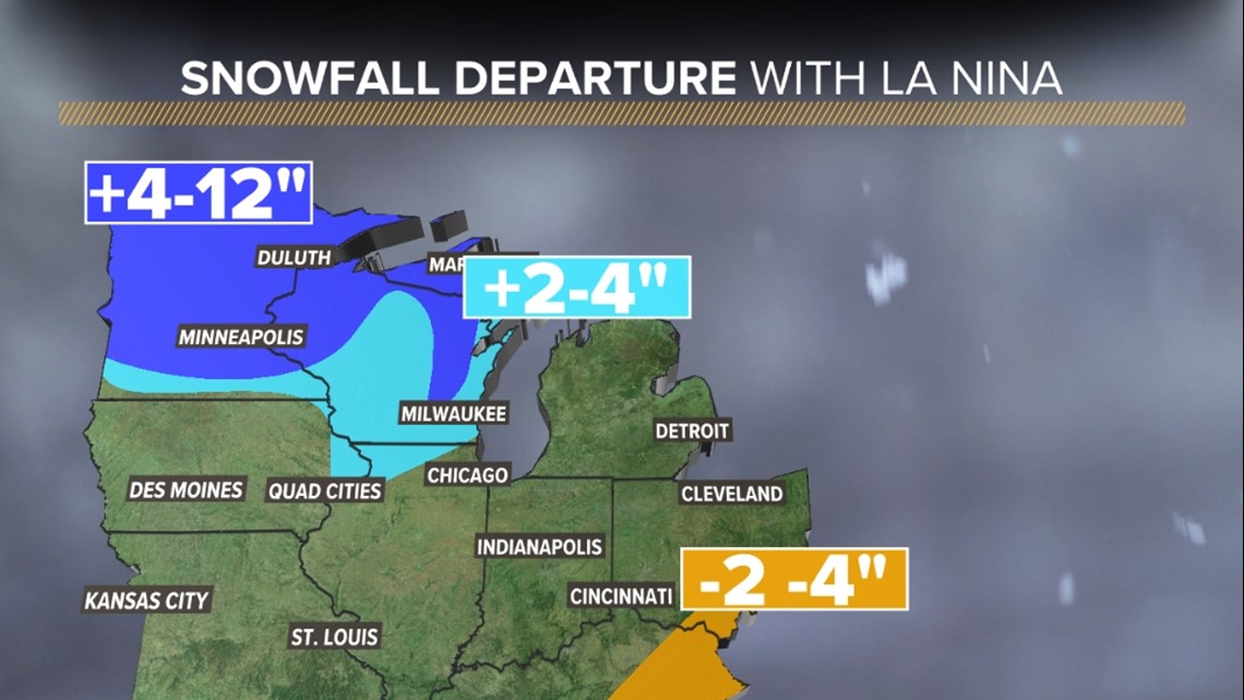
Past La Niña events have proven that certain areas of the upper Midwest, especially the Dakotas through parts of Minnesota and Wisconsin typically see an average of 2-4 more inches of snowfall for the season when compared to normal. As you can see with the map above, there is a small sliver of above-average snowfall that is observed right through the heart of the Quad Cities. Climatology proves that we can usually expect to see this during a year featuring La Niña.

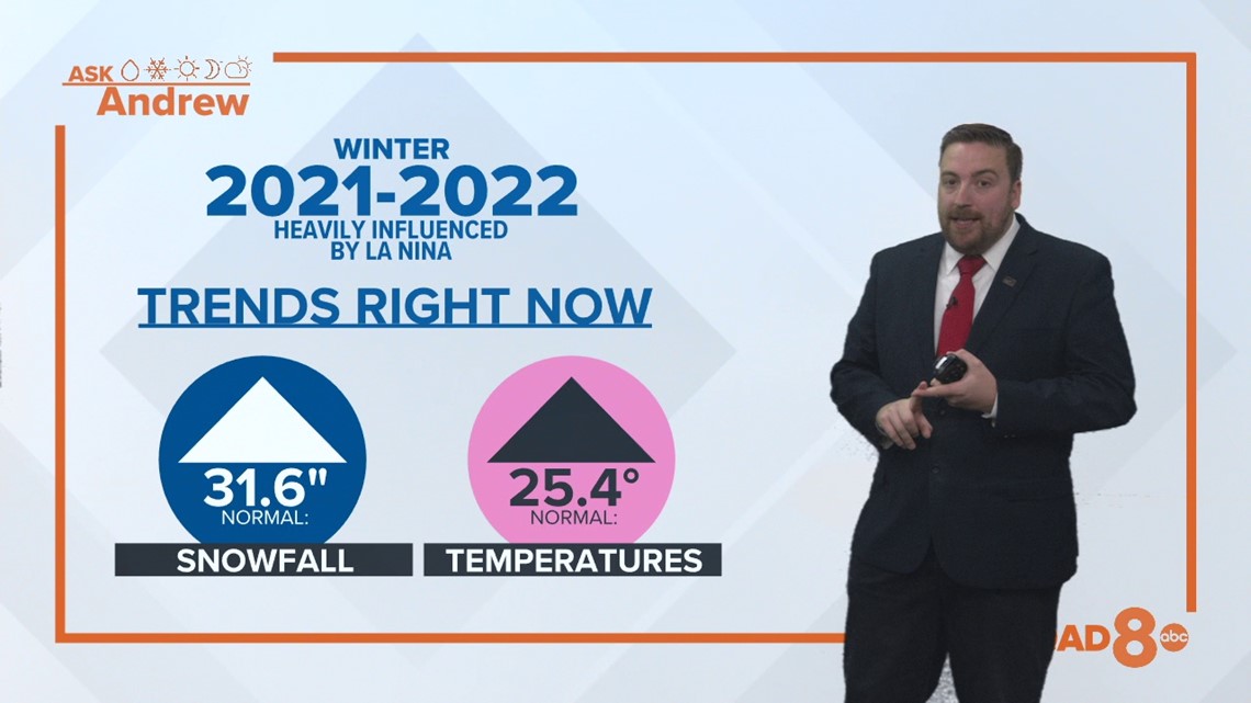
Above-average snowfall
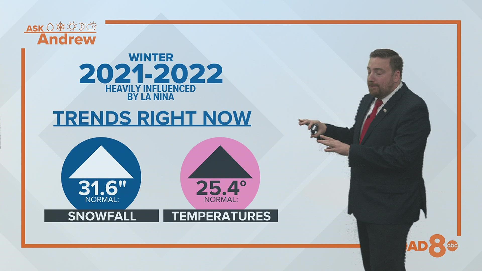
Using this information, it's safe to say at this point that above-average snowfall is a given.
We typically pick up just shy of 32" of snow in a given winter season. You can expect a bit more than that given the current pattern.
Temperature-wise, it was hard to tell just a few months ago what exactly this winter would bring in that department. Now that we are closer, there is a growing consensus that slightly warmer conditions can be expected. That doesn't mean we will be immune from the occasional outbreak of Arctic air masses, or even a visit from an offshoot of the polar vortex. It just means that when you take all of the high and low temperatures for each day during the season, they will likely equate to an average value that is slightly warmer when compared to normal.
There you have it! A preview of what's to come this winter season.
Have a weather question you'd like me to answer? Simply click here to submit it.